|
search place name
|
||
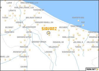
Sīāvarz (Iran)Sīāvarz is a town in Iran. An overview map of the region around Sīāvarz is displayed below.
regional and 3d topo map of Sīāvarz, Iran ::
Sīāvarz airports ::
The nearest airport is RZR - Ramsar, located 29.0 km north west of Sīāvarz.
Other airports nearby include THR - Teheran Mehrabad Intl (121.1 km south), RAS - Rasht (134.0 km north west), Nearby towns ::
Tashkadan (0.2km north west) //
Māzūbon-e Soflá (2.8km east) //
Garach Kaleh (3.5km north east) //
Kārdgar Maḩalleh (4.2km north west) //
Rāsh Kalām (4.6km south east) //
Qāshoqtarāsh (4.7km south west) //
Kalāmgāh (5.6km south) //
Māzūbon (4.8km north east) //
Khorramābād (5.5km north west) //
Līresar (7.3km south) //
Katrā (6.0km east) //
Mo‘allem Kūh (6.1km east) //
Ḩabībābād (6.1km east) //
Latāk (6.1km west) //
Qal‘eh Gardan (6.4km west) //
Baladeh-ye Bālā (7.3km north west) //
Chālū (8.0km south east) //
Kalāchpā (8.1km south west) //
Tonekābon (9.1km north) //
Baladeh-ye Pāʼīn (8.8km north west) //
Polsarā (8.2km south east) //
Sīāh Moshteh (9.3km south east) //
[all distances 'as the bird flies' and approximate]  Places with similar names to Sīāvarz, Iran ::
// Chafariz (PT)
// Chuvarez (RU)
// Chāh Fārsī (IR)
// Chāh Varz (IR)
// Cheviers (US)
// Shivers (US)
// Chavarrías (MX)
// Shāh Fīrūz (IR)
// Chefe Raice (MZ)
// Chefe Rosa (MZ)
Disclaimer :: Information on this page comes without warranty of any kind |
||
|
Where is Sīāvarz? Elevation and coordinates ::
Latitude (lat): 36°43'56"N Longitude (lon): 50°55'5"E
Elevation (approx.): 176m (map arrows pan, magnifying glasses zoom) |
||
|
Visiting Sīāvarz? Hotel/Accommodation ::
Book a hotel in Sīāvarz Travel Guide ::
Buy a travel guide for Iran rental cars ::
car rental offers GPS waypoint ::
download a GPX waypoint (PoI) of Sīāvarz for your GPS receiver
|
||