|
search place name
|
||
Sokkān (Eşfahān, Iran)Sokkān is a town in the Eşfahān region of Iran. An overview map of the region around Sokkān is displayed below.
regional and 3d topo map of Sokkān, Iran ::

Sokkān airports ::
The nearest airport is QMJ - Masjed Soleiman Shahid Asyaee, located 124.5 km south west of Sokkān.
Other airports nearby include AWZ - Ahwaz (212.3 km south west), Nearby towns ::
Mazrā'-e Keymās (1.7km south west) //
Gowhar Darreh (2.8km south) //
Korchān (3.1km west) //
Vahregān (3.5km south west) //
Māzeh Vahregān (4.7km south west) //
Eslāmābād (4.4km west) //
Abowl (4.8km west) //
Gūrāb (5.0km east) //
Cheshmeh-ye Ra'īsān (5.9km north east) //
Khorram Deh (6.6km south) //
Sīrzār (6.6km south east) //
Bāgh-e Shāh (8.8km north) //
Movāreh (8.0km north east) //
Mazra‘eh-ye Mīr (8.0km north west) //
Pūneh Kamar (10.4km south east) //
Fahreh (10.4km north west) //
[all distances 'as the bird flies' and approximate] 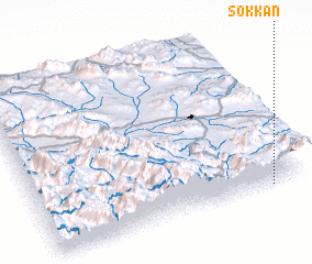 Places with similar names to Sokkān, Iran ::
Disclaimer :: Information on this page comes without warranty of any kind |
||
|
Where is Sokkān? Elevation and coordinates ::
Latitude (lat): 33°0'20"N Longitude (lon): 49°51'58"E
Elevation (approx.): 2502m (map arrows pan, magnifying glasses zoom) |
||
|
Visiting Sokkān? Hotel/Accommodation ::
Book a hotel in Sokkān Travel Guide ::
Buy a travel guide for Iran rental cars ::
car rental offers GPS waypoint ::
download a GPX waypoint (PoI) of Sokkān for your GPS receiver
|
||