|
search place name
|
||
Tang-e Robāţ (Khūzestān, Iran)Tang-e Robāţ is a town in the Khūzestān region of Iran. An overview map of the region around Tang-e Robāţ is displayed below.
regional and 3d topo map of Tang-e Robāţ, Iran ::

Tang-e Robāţ airports ::
The nearest airport is QMJ - Masjed Soleiman Shahid Asyaee, located 83.3 km north west of Tang-e Robāţ.
Other airports nearby include AWZ - Ahwaz (120.8 km west), MRX - Bandar Mahshahr Mahshahr (139.7 km south west), ABD - Abadan (216.1 km south west), Nearby towns ::
Robāţ (0.7km south east) //
Bar Āftāb (1.6km south) //
Māl Āqā (2.8km north east) //
Keyūp (3.2km south east) //
Chīdan (4.2km south) //
Tenbī (4.3km north west) //
Mongasht (5.3km south west) //
Lālab (5.3km south west) //
Nokhowdkār (5.4km north east) //
Bakhtegān-e ‘Olyā (6.0km south west) //
Tonbahār (6.0km north west) //
Bīdestān (7.2km north) //
Chāh Shīrīn (7.5km south) //
Jānakī (6.6km west) //
Ghāh-e Shīrīn (7.7km south) //
Deh Khomeyn (7.3km south west) //
Moleh-ye Shahrīārī (7.3km south west) //
Meleh-ye Abū ol ‘Abbās (8.1km south west) //
Balaghāb (8.8km north west) //
Bakhtegān-e Soflá (8.4km south west) //
Takyeh (11.2km north west) //
[all distances 'as the bird flies' and approximate] 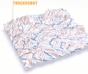 Places with similar names to Tang-e Robāţ, Iran ::
// Tenigerbad (CH)
// Tang-e Robāţ (IR)
Disclaimer :: Information on this page comes without warranty of any kind |
||
|
Where is Tang-e Robāţ? Elevation and coordinates ::
Latitude (lat): 31°35'0"N Longitude (lon): 50°0'0"E
Elevation (approx.): 1045m (map arrows pan, magnifying glasses zoom) |
||
|
Visiting Tang-e Robāţ? Hotel/Accommodation ::
Book a hotel in Tang-e Robāţ Travel Guide ::
Buy a travel guide for Iran rental cars ::
car rental offers GPS waypoint ::
download a GPX waypoint (PoI) of Tang-e Robāţ for your GPS receiver
|
||