|
search place name
|
||
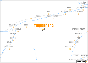
Tenigerbad (Aargau, Switzerland)Tenigerbad is a town in the Aargau region of Switzerland. An overview map of the region around Tenigerbad is displayed below.
regional and 3d topo map of Tenigerbad, Switzerland ::
Tenigerbad airports ::
The nearest airport is SMV - Samedan, located 72.2 km east of Tenigerbad.
Other airports nearby include LUG - Lugano (75.6 km south), ZRH - Zurich (92.5 km north), ACH - St Gallen Altenrhein (99.9 km north east), BRN - Bern Belp (115.1 km west), Nearby towns ::
Rabius (2.2km north west) //
Somvix (5.7km north) //
Ringgenberg (6.1km north east) //
Trun (7.5km north) //
Campliun (7.5km north) //
Disla (5.4km west) //
Compadials (6.7km north west) //
[all distances 'as the bird flies' and approximate] 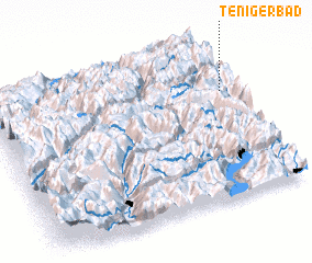 Places with similar names to Tenigerbad, Switzerland ::
// Tang-e Robāţ (IR)
// Tang-e Robāţ (IR)
Disclaimer :: Information on this page comes without warranty of any kind |
||
|
Where is Tenigerbad? Elevation and coordinates ::
Latitude (lat): 46°41'0"N Longitude (lon): 8°58'0"E
Elevation (approx.): 1310m (map arrows pan, magnifying glasses zoom) |
||
|
Visiting Tenigerbad? Hotel/Accommodation ::
Book a hotel in Tenigerbad Travel Guide ::
Buy a travel guide for Switzerland rental cars ::
car rental offers GPS waypoint ::
download a GPX waypoint (PoI) of Tenigerbad for your GPS receiver
|
||