|
search place name
|
||
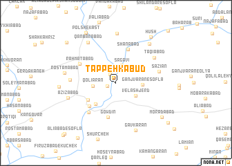
Tappeh Kabūd (Hamadān, Iran)Tappeh Kabūd is a town in the Hamadān region of Iran. An overview map of the region around Tappeh Kabūd is displayed below.
regional and 3d topo map of Tappeh Kabūd, Iran ::
Tappeh Kabūd airports ::
The nearest airport is KSH - Bakhtaran Shahid Ashrafi Esfahani, located 88.9 km west of Tappeh Kabūd.
Other airports nearby include SDG - Sanandaj (124.9 km north west), Nearby towns ::
Deh Bālā (1.2km south west) //
Sahm od Dīn (1.6km north west) //
Sagavī (3.0km north) //
Velāshjerd (3.3km south east) //
Qolīārān (3.1km west) //
Ganjvarān-e Soflá (3.5km east) //
Cheshmeh Nūsh (4.0km north west) //
Ḩoseynābād (4.4km south west) //
Ordūgāh-e Shohadā-ye Ḩalabcheh (4.6km south west) //
Gowdīn (5.6km south) //
Ţāherābād (5.1km south west) //
Shānābād (5.7km north) //
Kūcheh (6.0km south west) //
Raḩmatābād (5.7km north west) //
Sāzīān (6.0km east) //
Taqīābād (6.5km north east) //
Gol Bodāgh (6.1km west) //
Cheshmeh Qandāb (8.0km north) //
Qanbarābād (7.6km north west) //
‘Azīzābād (6.8km west) //
Mīnābād (7.7km north east) //
Gāvkarān (8.1km south) //
Rostamābād (7.1km west) //
Morādābād (8.3km south east) //
Hūsh (8.8km north east) //
Pol Shekast (9.0km north west) //
Bīfānaj (9.3km north west) //
Ţardābād (9.4km south east) //
Khamīsābād (10.3km south west) //
[all distances 'as the bird flies' and approximate] 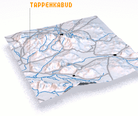 Places with similar names to Tappeh Kabūd, Iran ::
// Tappeh Kabūd (IR)
// Tappeh Kabūd (IR)
Disclaimer :: Information on this page comes without warranty of any kind |
||
|
Where is Tappeh Kabūd? Elevation and coordinates ::
Latitude (lat): 34°33'27"N Longitude (lon): 48°5'28"E
Elevation (approx.): 1493m (map arrows pan, magnifying glasses zoom) |
||
|
Visiting Tappeh Kabūd? Hotel/Accommodation ::
Book a hotel in Tappeh Kabūd Travel Guide ::
Buy a travel guide for Iran rental cars ::
car rental offers GPS waypoint ::
download a GPX waypoint (PoI) of Tappeh Kabūd for your GPS receiver
|
||