|
search place name
|
||
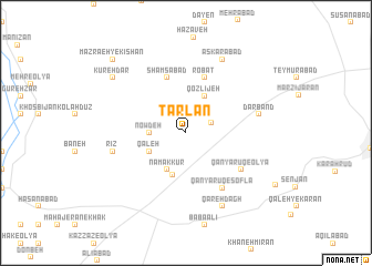
Ţarlān (Iran)Ţarlān is a town in Iran. An overview map of the region around Ţarlān is displayed below.
regional and 3d topo map of Ţarlān, Iran ::
Ţarlān airports ::
The nearest airport is THR - Teheran Mehrabad Intl, located 240.9 km north east of Ţarlān.
Nearby towns ::
Sāqī (2.4km north east) //
Kaleh-ye Namak Kūr (3.1km west) //
Now Deh (3.1km west) //
Qozlījeh (4.0km north) //
Namak Kūr (4.0km south) //
Qal‘eh (3.6km south west) //
Namak Kūr (4.4km south) //
Robāţ (5.8km north) //
Shamsābād (5.8km north) //
Qānyārūq-e ‘Olyā (5.9km south east) //
Qānyārūq-e Soflá (6.4km south east) //
Darband (6.4km east) //
Rīz (6.4km west) //
‘Askarābād (8.0km north) //
Qareh Dāgh (8.0km south east) //
Kūreh Dar (8.3km north west) //
Mazra‘eh-ye Kīshān (9.6km north west) //
Kīshān (9.6km north west) //
[all distances 'as the bird flies' and approximate] 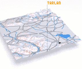 Places with similar names to Ţarlān, Iran ::
// Douar el Aouni (MA)
// Douar Laïna (MA)
// Tarulinna (RU)
// Torlino (RU)
// Torlino (RU)
// Troilin (RU)
// Turuallana (BO)
// Turlino (RU)
// Derlen (DE)
// Drilen (NO)
Disclaimer :: Information on this page comes without warranty of any kind |
||
|
Where is Ţarlān? Elevation and coordinates ::
Latitude (lat): 34°6'0"N Longitude (lon): 49°31'0"E
Elevation (approx.): 1962m (map arrows pan, magnifying glasses zoom) |
||
|
Visiting Ţarlān? Hotel/Accommodation ::
Book a hotel in Ţarlān Travel Guide ::
Buy a travel guide for Iran rental cars ::
car rental offers GPS waypoint ::
download a GPX waypoint (PoI) of Ţarlān for your GPS receiver
|
||