|
search place name
|
||
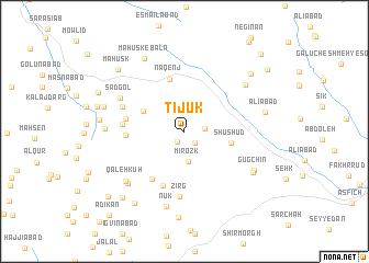
Tījūk (Khorāsān, Iran)Tījūk is a town in the Khorāsān region of Iran. An overview map of the region around Tījūk is displayed below.
regional and 3d topo map of Tījūk, Iran ::
Tījūk airports ::
The nearest airport is XBJ - Birjand, located 31.5 km south west of Tījūk.
Nearby towns ::
Jījong (1.3km south west) //
Roqq-e Bālā (1.5km south east) //
Shīrag (1.8km east) //
Mīrozk (3.1km south) //
Hāderābād (4.0km north west) //
Shūshūd (4.2km east) //
Naqenj (5.5km north) //
Reẕvān (5.6km south west) //
Nūghāb (5.8km south) //
Bīdesk (5.1km west) //
Samā' (5.1km west) //
Mīdasg (5.4km west) //
Zirg (6.7km south) //
Marūk (5.9km north west) //
Şad Gol (6.5km north west) //
Kākān (7.2km south west) //
Latī (7.0km north east) //
Qal‘eh Kūh (7.1km south west) //
Nūk (7.8km south) //
Pīshkūh (6.8km west) //
Gūgchīn (7.1km south east) //
Kalāteh-ye Pūzeh Balūch (7.2km south east) //
Māhūsk-e Bālā (8.1km north west) //
‘Alīābād (7.2km east) //
Tūrmān (7.3km west) //
Delābād (7.3km west) //
Gazīk (8.8km south) //
Khūnīk (8.5km south west) //
Seyyedābād (8.2km north east) //
[all distances 'as the bird flies' and approximate]  Places with similar names to Tījūk, Iran ::
Disclaimer :: Information on this page comes without warranty of any kind |
||
|
Where is Tījūk? Elevation and coordinates ::
Latitude (lat): 33°6'37"N Longitude (lon): 59°29'25"E
Elevation (approx.): 2126m (map arrows pan, magnifying glasses zoom) |
||
|
Visiting Tījūk? Hotel/Accommodation ::
Book a hotel in Tījūk Travel Guide ::
Buy a travel guide for Iran rental cars ::
car rental offers GPS waypoint ::
download a GPX waypoint (PoI) of Tījūk for your GPS receiver
|
||