|
search place name
|
||
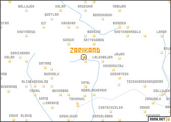
Zarī Kand (Ostān-e Āz̄arbāyjān-e Sharqī, Iran)Zarī Kand is a town in the Ostān-e Āz̄arbāyjān-e Sharqī region of Iran. An overview map of the region around Zarī Kand is displayed below.
regional and 3d topo map of Zarī Kand, Iran ::
Zarī Kand airports ::
The nearest airport is TBZ - Tabriz Intl, located 72.8 km south west of Zarī Kand.
Nearby towns ::
Zarrīn Rekāb (0.0km north) //
Lāleh Bejān (2.9km east) //
Seyyedābād (4.0km north) //
Sangīn (4.7km north west) //
Āqā Bābā Sang (5.6km south) //
Āgh Kandī (5.6km north) //
Kīfāl (5.6km south) //
Barāzīn (5.7km north) //
Khvoʼīn Dīzaj (5.1km east) //
Jājān (5.9km east) //
Dongāh (7.6km north) //
Āq Bolāgh-e Pāʼīn (7.6km south) //
Pūr Malek (6.1km west) //
Sīāh Kalān (7.7km south) //
Būrī Molk (6.9km south west) //
Goshāyesh (6.9km south east) //
Tāzeh Kand-e Bekrābād (8.0km south) //
Kakāvar (8.0km north) //
Nehrīq (7.7km south east) //
Bekrābād (8.6km south west) //
Qayeh Qeshlāq (8.0km south west) //
Bīrāneh (9.4km north east) //
[all distances 'as the bird flies' and approximate]  Places with similar names to Zarī Kand, Iran ::
// Şorkǝnd (AZ)
// Şurakǝnd (AZ)
// Şurakǝnd (AZ)
// Şurakǝnd (AZ)
// Cerro Cañito (PA)
// Saraykent (TR)
// Sarıkent (TR)
// Sarai Kānda (BD)
// Serkāndi (BD)
// Soārkāndi (BD)
Disclaimer :: Information on this page comes without warranty of any kind |
||
|
Where is Zarī Kand? Elevation and coordinates ::
Latitude (lat): 38°39'0"N Longitude (lon): 46°45'0"E
Elevation (approx.): 2301m (map arrows pan, magnifying glasses zoom) |
||
|
Visiting Zarī Kand? Hotel/Accommodation ::
Book a hotel in Zarī Kand Travel Guide ::
Buy a travel guide for Iran rental cars ::
car rental offers GPS waypoint ::
download a GPX waypoint (PoI) of Zarī Kand for your GPS receiver
|
||