|
search place name
|
||
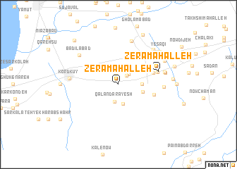
Zerā Maḩalleh (Iran)Zerā Maḩalleh is a town in Iran. An overview map of the region around Zerā Maḩalleh is displayed below.
regional and 3d topo map of Zerā Maḩalleh, Iran ::
Nearby towns ::
Chahār Deh (1.4km north) //
Īlvārīn (1.7km north east) //
Īlvār-e Panj Dāngeh (2.0km north east) //
Qalandar Āyesh (2.8km south) //
Bālā Jāddeh (3.1km south) //
Khorramābād (3.0km east) //
Mīān Darreh (3.3km east) //
Alang (3.6km north west) //
Vod Maḩalleh (4.5km north east) //
Gorjī Maḩalleh (5.1km north east) //
Cheqer (4.8km east) //
Shāhedeh (4.8km north east) //
Mofīdābād (5.3km east) //
Zerā‘ Maḩalleh (5.5km east) //
Mehtar Kalāteh (7.1km north) //
Nāman (5.8km east) //
Moḩammadābād (6.1km east) //
Dar Do Maḩalleh (6.2km east) //
Badīlābād (6.8km north west) //
Kord Kūy (6.3km west) //
Pīshīnī Kalāteh (7.1km north east) //
Dowrūd Maḩalleh (6.9km north east) //
Yesāqī (7.4km north east) //
Dangelān (7.0km east) //
Ja‘far-e Farzāneh (8.5km north) //
Eslāmābād (7.6km east) //
Zābolī Maḩalleh-ye Pā'īn (8.9km north west) //
[all distances 'as the bird flies' and approximate] 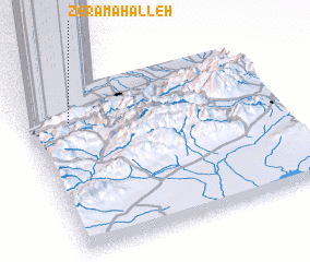 Places with similar names to Zerā Maḩalleh, Iran ::
// Sarmahal (BD)
// Zerāmahal (IN)
// Sar Maḩalleh (IR)
// Zārī Maḩalleh (IR)
// Zīār Maḩalleh (IR)
// Zīār Maḩalleh (IR)
// Zīār Maḩalleh (IR)
// Zerā‘ Maḩalleh (IR)
Disclaimer :: Information on this page comes without warranty of any kind |
||
|
Where is Zerā Maḩalleh? Elevation and coordinates ::
Latitude (lat): 36°47'0"N Longitude (lon): 54°11'0"E
Elevation (approx.): 39m (map arrows pan, magnifying glasses zoom) |
||
|
Visiting Zerā Maḩalleh? Hotel/Accommodation ::
Book a hotel in Zerā Maḩalleh Travel Guide ::
Buy a travel guide for Iran rental cars ::
car rental offers GPS waypoint ::
download a GPX waypoint (PoI) of Zerā Maḩalleh for your GPS receiver
|
||