|
search place name
|
||
Kord Kūy (Golestān, Iran)Kord Kūy is a town in the Golestān region of Iran. An overview map of the region around Kord Kūy is displayed below.
regional and 3d topo map of Kord Kūy, Iran ::
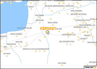
Nearby towns ::
Lāghūz (1.5km south west) //
Valāghūz (3.5km south west) //
Badīlābād (3.9km north) //
Sālī Kandeh (3.6km south west) //
Alang (3.6km east) //
Qareh Sū (5.3km north west) //
Zābolī Maḩalleh-ye Pā'īn (6.1km north) //
Banī (6.6km south) //
Namāzābād (7.0km north) //
Emāmzādeh Chahār Kūh (7.0km south) //
Nīāzābād (7.0km north west) //
Chahār Deh (6.0km east) //
Zerā Maḩalleh (6.3km east) //
Qalandar Āyesh (6.8km south east) //
Sar Kalāteh-ye Kharāb Shahr (7.6km south west) //
Bāghū Kenāreh (7.2km west) //
Kār Kondeh (7.5km south west) //
Sūteh Deh (7.7km south west) //
Zābolī Maḩalleh-ye Bālā (9.0km north) //
Zābolī Maḩalleh-ye Kohneh (9.0km north) //
Bālā Jāddeh (7.9km south east) //
Bāghū (8.5km south west) //
Āshūrābād (10.0km north east) //
[all distances 'as the bird flies' and approximate] 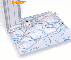 Places with similar names to Kord Kūy, Iran ::
Disclaimer :: Information on this page comes without warranty of any kind |
||
|
Where is Kord Kūy? Elevation and coordinates ::
Latitude (lat): 36°47'30"N Longitude (lon): 54°6'48"E
Elevation (approx.): -2m (map arrows pan, magnifying glasses zoom) |
||
|
Visiting Kord Kūy? Hotel/Accommodation ::
Book a hotel in Kord Kūy Travel Guide ::
Buy a travel guide for Iran rental cars ::
car rental offers GPS waypoint ::
download a GPX waypoint (PoI) of Kord Kūy for your GPS receiver
|
||