|
search place name
|
||
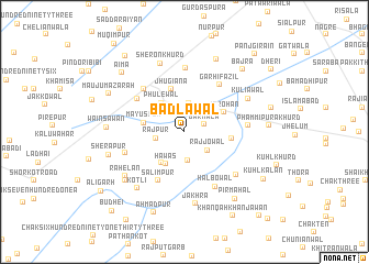
Bādlawāl (Punjab, Pakistan)Bādlawāl is a town in the Punjab region of Pakistan. An overview map of the region around Bādlawāl is displayed below.
regional and 3d topo map of Bādlawāl, Pakistan ::
Bādlawāl airports ::
The nearest airport is LYP - Faisalabad Intl, located 83.1 km north east of Bādlawāl.
Other airports nearby include MUX - Multan Intl (115.9 km south west), Nearby towns ::
Barnāla (1.9km north east) //
Kāra Bāra (2.9km south) //
Rajjowāl (2.7km south east) //
Hokrān (3.0km north) //
Rājpur (2.6km west) //
Hawās (3.6km south west) //
Phūlewāl (3.5km north west) //
Bachhriānwala (3.7km south west) //
Māyūspur (3.7km west) //
Jarohān (4.0km north east) //
Jhugiāna (4.5km north) //
Chūharwāla (4.2km east) //
Salīmpur (5.4km south west) //
Qādirābād (5.3km north west) //
Garhi Fāzil (5.7km north east) //
Chutiāna (5.6km north west) //
Halbowāl (6.2km south east) //
Nūrpur (5.6km south west) //
Gilpur (6.5km north) //
Nangal Kalān (5.6km east) //
Khāsi Kalān (6.2km south east) //
Kuliāwāl (6.5km north east) //
Jākhra (7.3km south) //
Sheron Khurd (7.3km north) //
Kotli (7.0km south west) //
Rāhelān (6.8km south west) //
Khīkha (7.2km south west) //
Wains Awān (6.8km west) //
Sherāpur (7.0km west) //
[all distances 'as the bird flies' and approximate]  Places with similar names to Bādlawāl, Pakistan ::
// Bout el Wali (TD)
// Badalwāla (PK)
// Badalwāla (PK)
// Badlewāla (PK)
// Bātilwāla (PK)
// Bītalwāla (PK)
// Bodalwāli (PK)
// Bodlāwāla (PK)
// Badullawala (LK)
// Baduluwela (LK)
Disclaimer :: Information on this page comes without warranty of any kind |
||
|
Where is Bādlawāl? Elevation and coordinates ::
Latitude (lat): 30°49'40"N Longitude (lon): 72°23'15"E
Elevation (approx.): 155m (map arrows pan, magnifying glasses zoom) |
||
|
Visiting Bādlawāl? Hotel/Accommodation ::
Book a hotel in Bādlawāl Travel Guide ::
Buy a travel guide for Pakistan rental cars ::
car rental offers GPS waypoint ::
download a GPX waypoint (PoI) of Bādlawāl for your GPS receiver
|
||