|
search place name
|
||
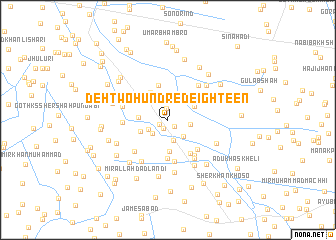
Deh Two Hundred Eighteen (Sind, Pakistan)Deh Two Hundred Eighteen is a town in the Sind region of Pakistan. An overview map of the region around Deh Two Hundred Eighteen is displayed below.
regional and 3d topo map of Deh Two Hundred Eighteen, Pakistan ::
Deh Two Hundred Eighteen airports ::
The nearest airport is BDN - Talhar, located 74.4 km south west of Deh Two Hundred Eighteen.
Other airports nearby include WNS - Nawabshah (128.5 km north west), JSA - Jaisalmer (230.4 km north east), MJD - Moenjodaro (244.2 km north west), Nearby towns ::
Hāji Abdullāh (1.0km south west) //
Sāhar (1.0km south west) //
Siddīq Khāskheli (1.0km south east) //
Mīma (1.2km north) //
Waryām Lanjwāni (2.2km south west) //
Bhangar Khān (2.4km south) //
Usmān Khāskheli (2.2km south west) //
Yār Muhammad Bhurgari (2.4km south east) //
Gul Muhammad (2.3km east) //
Mānjhi Khāskheli (2.9km west) //
Dingān Bhurgari (3.1km north west) //
Bādal Khāskheli (3.1km north east) //
Deh Two Hundred Thirty-three (3.1km south west) //
Allāh Ditta (3.3km north west) //
Muhammad Hāshim (3.6km south) //
Dingān Bhurgari (3.3km north west) //
Jān Muhammad Bhurgari (3.6km north west) //
Dost Muhammad Bhurgari (4.0km north) //
Deh Two Hundred Ten (4.3km south) //
Ali Muhammad Bhurgari (4.3km south east) //
Arāro Bhurgari (4.3km north east) //
Deh Two Hundred Nine (4.4km south east) //
Modo (4.7km south) //
Abbās Māchhi (4.8km south east) //
Deh Two Hundred Thirty-three (4.6km west) //
Deh Two Hundred Eleven (4.9km south west) //
Hāji Muhammad Siddīq (4.9km north east) //
Hāji Jān Muhammad Bhurgari (5.1km south east) //
Deh Two Hundred Twenty-one (4.9km west) //
[all distances 'as the bird flies' and approximate]  Places with similar names to Deh Two Hundred Eighteen, Pakistan ::
// Deh Two Hundred Ten (PK)
Disclaimer :: Information on this page comes without warranty of any kind |
||
|
Where is Deh Two Hundred Eighteen? Elevation and coordinates ::
Latitude (lat): 25°22'55"N Longitude (lon): 69°16'35"E
Elevation (approx.): 14m (map arrows pan, magnifying glasses zoom) |
||
|
Visiting Deh Two Hundred Eighteen? Hotel/Accommodation ::
Book a hotel in Deh Two Hundred Eighteen Travel Guide ::
Buy a travel guide for Pakistan rental cars ::
car rental offers GPS waypoint ::
download a GPX waypoint (PoI) of Deh Two Hundred Eighteen for your GPS receiver
|
||