|
search place name
|
||
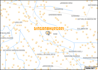
Dingān Bhurgari (Sind, Pakistan)Dingān Bhurgari is a town in the Sind region of Pakistan. An overview map of the region around Dingān Bhurgari is displayed below.
regional and 3d topo map of Dingān Bhurgari, Pakistan ::
Dingān Bhurgari airports ::
The nearest airport is BDN - Talhar, located 74.7 km south west of Dingān Bhurgari.
Other airports nearby include WNS - Nawabshah (125.4 km north west), JSA - Jaisalmer (230.6 km north east), MJD - Moenjodaro (241.3 km north west), Nearby towns ::
Dingān Bhurgari (0.3km west) //
Allāh Ditta (1.0km north east) //
Jān Muhammad Bhurgari (1.2km north east) //
Mānjhi Khāskheli (1.8km south) //
Dost Muhammad Bhurgari (2.3km north east) //
Deh Two Hundred Twenty-one (2.3km west) //
Mīma (2.4km east) //
Hāji Abdullāh (2.9km south east) //
Usmān Khāskheli (3.1km south) //
Deh Two Hundred Thirty-three (3.3km south) //
Deh Two Hundred Eighteen (3.1km south east) //
Deh Two Hundred Thirty-three (3.2km south west) //
Deh Two Hundred Thirty-three (3.2km west) //
Sāhar (3.5km south east) //
Waryām Lanjwāni (3.6km south) //
Goth Hāji Jia (3.5km north west) //
Deh Two Hundred Twenty-three (3.7km north west) //
Siddīq Khāskheli (4.1km south east) //
Subedār jo Goth (4.3km north west) //
Bhangar Khān (5.2km south east) //
Deh Two Hundred Thirty-three (5.1km south west) //
Qayūmābād (5.4km south west) //
Bādal Khāskheli (5.0km east) //
Gul Muhammad (5.2km south east) //
Deh Two Hundred Eleven (5.6km south) //
Goth Umed Ali Dal (5.7km north) //
Yār Muhammad Bhurgari (5.5km south east) //
Goth Mīr Ghulām Hussain Tālpur (5.4km south west) //
Goth Muhammad Hāshim (5.6km south west) //
[all distances 'as the bird flies' and approximate]  Places with similar names to Dingān Bhurgari, Pakistan ::
// Dingān Bhurgari (PK)
Disclaimer :: Information on this page comes without warranty of any kind |
||
|
Where is Dingān Bhurgari? Elevation and coordinates ::
Latitude (lat): 25°24'0"N Longitude (lon): 69°15'10"E
Elevation (approx.): 17m (map arrows pan, magnifying glasses zoom) |
||
|
Visiting Dingān Bhurgari? Hotel/Accommodation ::
Book a hotel in Dingān Bhurgari Travel Guide ::
Buy a travel guide for Pakistan rental cars ::
car rental offers GPS waypoint ::
download a GPX waypoint (PoI) of Dingān Bhurgari for your GPS receiver
|
||