|
search place name
|
||
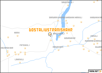
Dost Ali Ustrāni Shahr (Balochistān, Pakistan)Dost Ali Ustrāni Shahr is a town in the Balochistān region of Pakistan. An overview map of the region around Dost Ali Ustrāni Shahr is displayed below.
regional and 3d topo map of Dost Ali Ustrāni Shahr, Pakistan ::
Dost Ali Ustrāni Shahr airports ::
The nearest airport is PZH - Zhob, located 155.3 km north of Dost Ali Ustrāni Shahr.
Other airports nearby include SUL - Sui (160.5 km south), UET - Quetta (184.8 km west), RYK - Rahim Yar Khan Sheikh Zayed (232.7 km south east), Nearby towns ::
Alif Kili (1.4km south) //
Mānzkai Kili (2.7km east) //
Nasīr Khān (5.5km south east) //
Nimki (5.2km east) //
Mānzai (6.2km north) //
Ālam Shaikh (6.1km north east) //
Chotiāli (6.3km south east) //
Doda Shahr (6.4km east) //
Shāhābād (7.1km north east) //
Sardār Muhammad Hāshim Khān Kili (7.6km north east) //
Nauroz Khān Kili (8.3km north east) //
[all distances 'as the bird flies' and approximate]  Places with similar names to Dost Ali Ustrāni Shahr, Pakistan :: Disclaimer :: Information on this page comes without warranty of any kind |
||
|
Where is Dost Ali Ustrāni Shahr? Elevation and coordinates ::
Latitude (lat): 30°3'50"N Longitude (lon): 68°50'40"E
Elevation (approx.): 938m (map arrows pan, magnifying glasses zoom) |
||
|
Visiting Dost Ali Ustrāni Shahr? Hotel/Accommodation ::
Book a hotel in Dost Ali Ustrāni Shahr Travel Guide ::
Buy a travel guide for Pakistan rental cars ::
car rental offers GPS waypoint ::
download a GPX waypoint (PoI) of Dost Ali Ustrāni Shahr for your GPS receiver
|
||