|
search place name
|
||
Fateh Khān (Punjab, Pakistan)Fateh Khān is a town in the Punjab region of Pakistan. An overview map of the region around Fateh Khān is displayed below.
regional and 3d topo map of Fateh Khān, Pakistan ::

Fateh Khān airports ::
The nearest airport is PEW - Peshawar Intl, located 144.7 km north of Fateh Khān.
Other airports nearby include ISB - Islamabad Chaklala (154.6 km north east), LYP - Faisalabad Intl (185.7 km south east), RAZ - Rawala Kot Rawalakot (222.0 km north east), JAA - Jalalabad (224.1 km north west), Nearby towns ::
Dhok Muhammad Khel (NaNkm north) //
Bhir Shāh Niwāz (1.2km south) //
Mehra (1.9km north) //
Sultān Ahmad (1.9km north) //
Dhok Muhammad Yār (1.6km east) //
Bhir Nūr Ahmad Khelwāli (1.9km south) //
Dhok Muhammad Khānwāli (1.9km south) //
Allu (2.4km north west) //
Madad Khān (2.4km north east) //
Pindi Sherang (2.4km north east) //
Nāoni (2.4km south east) //
Yār Gul (3.3km north) //
Nūr Muhammad (3.2km north east) //
Rahmān (3.1km west) //
Chak Dāh (3.1km east) //
Dhok Baloch Geru (3.7km south) //
Mehr Khān (3.6km north west) //
Qāzi Sharfuddīn (3.6km north west) //
Rikhi (3.6km south west) //
Dhok Bhakkar (3.6km south east) //
Khudāyār (3.6km south east) //
Jangwalānwāla (4.0km south east) //
Dhok Chhappar (4.0km south east) //
Gul Muhammad (3.5km west) //
Nūr Muhammad (4.0km north east) //
Miān Shāhbāzwāla (4.5km north east) //
Ziārat Hāfizj (4.8km south west) //
Dhok Geruānwāli (4.8km south east) //
Dhok Bānera (4.8km south east) //
[all distances 'as the bird flies' and approximate] 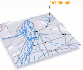 Places with similar names to Fateh Khān, Pakistan ::
// Vidakhino (RU)
// Vitakhino (RU)
// Ghātākhān (BD)
// Fateh Khān (PK)
// Fateh Khān (PK)
// Fateh Khān (PK)
// Fateh Khān (PK)
// Fateh Khān (PK)
// Fateh Khān (PK)
// Fateh Khān (PK)
Disclaimer :: Information on this page comes without warranty of any kind |
||
|
Where is Fateh Khān? Elevation and coordinates ::
Latitude (lat): 32°43'0"N Longitude (lon): 71°50'0"E
Elevation (approx.): 357m (map arrows pan, magnifying glasses zoom) |
||
|
Visiting Fateh Khān? Hotel/Accommodation ::
Book a hotel in Fateh Khān Travel Guide ::
Buy a travel guide for Pakistan rental cars ::
car rental offers GPS waypoint ::
download a GPX waypoint (PoI) of Fateh Khān for your GPS receiver
|
||