|
search place name
|
||
Fateh Khān (Punjab, Pakistan)Fateh Khān is a town in the Punjab region of Pakistan. An overview map of the region around Fateh Khān is displayed below.
regional and 3d topo map of Fateh Khān, Pakistan ::

Fateh Khān airports ::
The nearest airport is PEW - Peshawar Intl, located 149.7 km north of Fateh Khān.
Other airports nearby include ISB - Islamabad Chaklala (171.4 km north east), LYP - Faisalabad Intl (189.9 km south east), JAA - Jalalabad (222.3 km north west), MFG - Muzaffarabad (253.7 km north east), Nearby towns ::
Dalīlīwāla (1.6km east) //
Masti Khelānwāla (1.6km west) //
Chittawatta (2.3km north) //
Ālam Khānwāla (2.4km north west) //
Bāgh (3.7km north) //
Mawāzwāla (3.1km west) //
Jaurīānwāla (4.0km south east) //
Utla Punu Khelānwāla (4.0km south west) //
Chhaboranwāla (4.0km south west) //
Gulbāzwāla (3.6km north west) //
Hīrānwāla (3.6km south west) //
Khabāri (3.6km south west) //
Madi Khelānwāla (4.2km south east) //
Ahmadwāla (4.9km south) //
Palluwāla (4.8km north east) //
Samandi Khelānwāla (4.8km north west) //
Uba Khel (5.6km south) //
Ghundi (5.6km north) //
Begu Khelānwāla (5.8km south) //
Chhaborewāla (5.8km south) //
Muslūwāla (5.8km south) //
Tarla Punu Khelānwāla (5.8km south) //
Mehar Khānwāla (5.0km west) //
Bairam Khelānwāla (5.0km west) //
Bākīwāla (5.9km south west) //
Wīrkala (6.4km south east) //
Ghāzi Khānwāla (6.4km south east) //
Dalāsi (6.4km south east) //
Chardewāla (6.4km south east) //
[all distances 'as the bird flies' and approximate] 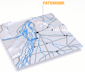 Places with similar names to Fateh Khān, Pakistan ::
// Vidakhino (RU)
// Vitakhino (RU)
// Ghātākhān (BD)
// Fateh Khān (PK)
// Fateh Khān (PK)
// Fateh Khān (PK)
// Fateh Khān (PK)
// Fateh Khān (PK)
// Fateh Khān (PK)
// Fateh Khān (PK)
Disclaimer :: Information on this page comes without warranty of any kind |
||
|
Where is Fateh Khān? Elevation and coordinates ::
Latitude (lat): 32°39'0"N Longitude (lon): 71°40'0"E
Elevation (approx.): 243m (map arrows pan, magnifying glasses zoom) |
||
|
Visiting Fateh Khān? Hotel/Accommodation ::
Book a hotel in Fateh Khān Travel Guide ::
Buy a travel guide for Pakistan rental cars ::
car rental offers GPS waypoint ::
download a GPX waypoint (PoI) of Fateh Khān for your GPS receiver
|
||