|
search place name
|
||
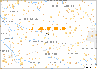
Goth Ghulām Nabi Shāh (Sind, Pakistan)Goth Ghulām Nabi Shāh is a town in the Sind region of Pakistan. An overview map of the region around Goth Ghulām Nabi Shāh is displayed below.
regional and 3d topo map of Goth Ghulām Nabi Shāh, Pakistan ::
Goth Ghulām Nabi Shāh airports ::
The nearest airport is BDN - Talhar, located 77.4 km south of Goth Ghulām Nabi Shāh.
Other airports nearby include WNS - Nawabshah (88.1 km north west), KHI - Karachi Jinnah Intl (183.9 km west), MJD - Moenjodaro (210.9 km north), Nearby towns ::
Goth Muhammad Ali Dars (0.4km north east) //
Goth Hāji Allāh Dād (0.7km north west) //
Goth Wali Muhammad Dars (1.2km north east) //
Goth Dital Khāskheli (1.5km north) //
Goth Nimro (1.8km south west) //
Goth Kesu Mal (1.8km east) //
Goth Mewa Khāskheli (2.0km north) //
Goth Firoz Shāh (1.8km east) //
Goth Landhi Mīr Hāji Ghulām Muhammad (2.2km north east) //
Jhando Jarwār (2.5km north west) //
Goth Qurbān Ali Shāh (2.7km north east) //
Goth Feroz Mangsi (3.0km north east) //
Goth Dhanrāi Mal (2.9km east) //
Goth Allan Faqīr (3.0km north west) //
Goth Muhammad Ali Lund (3.4km north west) //
Goth Shāh Beg Lund (3.5km west) //
Goth Umed Ali Dal (3.9km south) //
Goth Bangu Mangsi (3.7km north east) //
Sultānābād (4.1km south) //
Goth Chaudhri Khushi Muhammad (4.2km north) //
Goth Kamāl Mastoi (4.2km north west) //
Goth Mīr Dād (4.6km south east) //
Goth Abdul Sattār Quraishi (4.8km north east) //
Goth Sobho Mastoi (5.1km north) //
Goth Rūp Chand (5.0km south east) //
Sultānābād II (5.3km south) //
Piāra Lund (4.9km west) //
Sultānābād III (5.6km south) //
Umīd Ali Dal (5.8km south west) //
[all distances 'as the bird flies' and approximate]  Places with similar names to Goth Ghulām Nabi Shāh, Pakistan :: Disclaimer :: Information on this page comes without warranty of any kind |
||
|
Where is Goth Ghulām Nabi Shāh? Elevation and coordinates ::
Latitude (lat): 25°32'25"N Longitude (lon): 68°50'50"E
Elevation (approx.): 19m (map arrows pan, magnifying glasses zoom) |
||
|
Visiting Goth Ghulām Nabi Shāh? Hotel/Accommodation ::
Book a hotel in Goth Ghulām Nabi Shāh Travel Guide ::
Buy a travel guide for Pakistan rental cars ::
car rental offers GPS waypoint ::
download a GPX waypoint (PoI) of Goth Ghulām Nabi Shāh for your GPS receiver
|
||