|
search place name
|
||
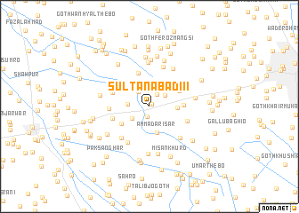
Sultānābād III (Sind, Pakistan)Sultānābād III is a town in the Sind region of Pakistan. An overview map of the region around Sultānābād III is displayed below.
regional and 3d topo map of Sultānābād III, Pakistan ::
Sultānābād III airports ::
The nearest airport is BDN - Talhar, located 71.9 km south of Sultānābād III.
Other airports nearby include WNS - Nawabshah (92.9 km north west), KHI - Karachi Jinnah Intl (182.0 km west), MJD - Moenjodaro (216.2 km north), Nearby towns ::
Sultānābād II (0.4km north east) //
Muhammad Umar Kākepota (1.3km south) //
Sultānābād (1.8km north east) //
Goth Umed Ali Dal (2.2km north west) //
Goth Mīr Dād (2.3km north east) //
Ismāīl Kākepota (2.5km south west) //
Umīd Ali Dal (2.5km west) //
Ahmad Arīsar (3.3km south) //
Mīr jo Goth (3.2km east) //
Usmān Baoch (3.9km south west) //
Goth Rūp Chand (3.9km north east) //
Bābu jo Goth (3.9km east) //
Goth Nimro (4.4km north) //
Rahmatullāh (4.5km west) //
Goth Hīra Singh (4.5km west) //
Dars Pīru (4.6km west) //
Jāfar jo Goth (4.7km south east) //
Goth Kesu Mal (5.2km north) //
Kamāro Sharīf (5.1km south west) //
Kākepota (5.1km south west) //
Goth Ghulām Nabi Shāh (5.6km north) //
Muhammad Pal jo Goth (5.3km south east) //
Goth Dhanrāi Mal (5.5km north east) //
Bulgai (5.3km east) //
Goth Muhammad Ali Dars (5.9km north) //
Goth Firoz Shāh (6.0km north) //
Mubārak jo Otāq (6.0km south) //
Hāji Matāro (6.1km south) //
Goth Hāji Allāh Dād (6.2km north) //
[all distances 'as the bird flies' and approximate] 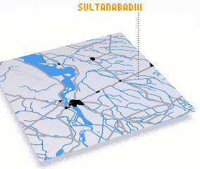 Places with similar names to Sultānābād III, Pakistan ::
// Sultanabat (TR)
// Sultan-Abad (UZ)
// Sultanabad (UZ)
// Sultanabad (UZ)
// Solţanābād (IR)
// Solţānābād (IR)
// Solţānābād (IR)
// Solţānābād (IR)
// Solţānābād (IR)
// Solţānābād (IR)
Disclaimer :: Information on this page comes without warranty of any kind |
||
|
Where is Sultānābād III? Elevation and coordinates ::
Latitude (lat): 25°29'25"N Longitude (lon): 68°50'55"E
Elevation (approx.): 23m (map arrows pan, magnifying glasses zoom) |
||
|
Visiting Sultānābād III? Hotel/Accommodation ::
Book a hotel in Sultānābād III Travel Guide ::
Buy a travel guide for Pakistan rental cars ::
car rental offers GPS waypoint ::
download a GPX waypoint (PoI) of Sultānābād III for your GPS receiver
|
||