|
search place name
|
||
Gulukhtori (North-West Frontier, Pakistan)Gulukhtori is a town in the North-West Frontier region of Pakistan. An overview map of the region around Gulukhtori is displayed below.
regional and 3d topo map of Gulukhtori, Pakistan ::

Gulukhtori airports ::
The nearest airport is SDT - Saidu Sharif, located 134.4 km south of Gulukhtori.
Other airports nearby include JAA - Jalalabad (220.3 km south west), PEW - Peshawar Intl (224.2 km south), MFG - Muzaffarabad (230.4 km south east), Nearby towns ::
Khamkoru (0.2km south east) //
Shaghur (0.5km north east) //
Purdesh (0.8km north east) //
Mulen More (1.0km south) //
Mashāgho Lasht (1.1km east) //
Mulen More Lasht (1.4km south) //
Chamuruk (1.7km north east) //
Istan Lasht (2.3km south) //
Turen More (2.3km north east) //
Morestān (3.5km west) //
Borghozi (4.1km south west) //
Koghozi (5.0km south west) //
Golen (5.8km south) //
Maroi (5.6km north east) //
Bobaka (6.3km south) //
Turen Kuzhu (7.0km south west) //
Mulen Kuzhu (8.6km south west) //
[all distances 'as the bird flies' and approximate] 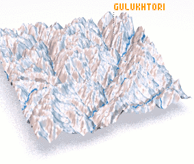 Places with similar names to Gulukhtori, Pakistan ::
// Kılıçdere (TR)
// Koulkadouri (BJ)
// Gouli Godiaré (BF)
// Kilakkettara (IN)
// Kalak Darreh (IR)
// Kal Akhtar (IR)
// Kaleh Qaţār (IR)
// Kaleh Qaţār (IR)
// Kalgā Darreh (IR)
// Kal Godār (IR)
Disclaimer :: Information on this page comes without warranty of any kind |
||
|
Where is Gulukhtori? Elevation and coordinates ::
Latitude (lat): 35°58'53"N Longitude (lon): 71°57'40"E
Elevation (approx.): 1705m (map arrows pan, magnifying glasses zoom) |
||
|
Visiting Gulukhtori? Hotel/Accommodation ::
Book a hotel in Gulukhtori Travel Guide ::
Buy a travel guide for Pakistan rental cars ::
car rental offers GPS waypoint ::
download a GPX waypoint (PoI) of Gulukhtori for your GPS receiver
|
||