|
search place name
|
||
Jabborān (Pakistan)Jabborān is a town in Pakistan. An overview map of the region around Jabborān is displayed below.
regional and 3d topo map of Jabborān, Pakistan ::

Jabborān airports ::
The nearest airport is RAZ - Rawala Kot Rawalakot, located 64.8 km north west of Jabborān.
Other airports nearby include SXR - Srinagar (93.1 km north east), IXJ - Jammu (97.4 km south east), ISB - Islamabad Chaklala (101.2 km west), MFG - Muzaffarabad (125.2 km north west), Nearby towns ::
Pithanā (0.9km south) //
Kund (1.6km north) //
Khad Brahmanan (1.6km north east) //
Khad Telian (1.5km east) //
Gura Gurarār (1.9km south) //
Thākrakot (1.9km west) //
Khola (2.8km south) //
Phalni (2.9km north east) //
Atian (2.8km west) //
Khand Keri (3.2km north east) //
Jambīri (3.5km south west) //
Torwāl (3.4km north west) //
Pīr Marādhi (3.6km south) //
Kot Ketaro (3.2km west) //
Mitthi Dhara (3.2km east) //
Kas (3.8km south) //
Langar (3.4km west) //
Torila (4.0km north west) //
Pīr Badesar (4.3km south) //
Araān (4.3km north) //
Sarsala (4.2km south east) //
Rapri (3.9km south west) //
Kaila (4.4km north west) //
Gambi Bera (4.4km north west) //
Dharmsal (4.6km north east) //
Saonti (4.6km south east) //
Sarīla (5.2km south) //
Roual (4.7km south east) //
Bīsāli (4.7km east) //
[all distances 'as the bird flies' and approximate] 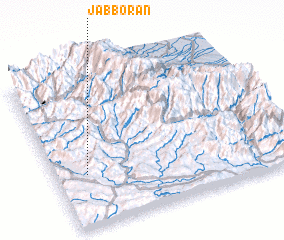 Places with similar names to Jabborān, Pakistan ::
Disclaimer :: Information on this page comes without warranty of any kind |
||
|
Where is Jabborān? Elevation and coordinates ::
Latitude (lat): 33°20'20"N Longitude (lon): 74°8'10"E
Elevation (approx.): 1126m (map arrows pan, magnifying glasses zoom) |
||
|
Visiting Jabborān? Hotel/Accommodation ::
Book a hotel in Jabborān Travel Guide ::
Buy a travel guide for Pakistan rental cars ::
car rental offers GPS waypoint ::
download a GPX waypoint (PoI) of Jabborān for your GPS receiver
|
||