|
search place name
|
||
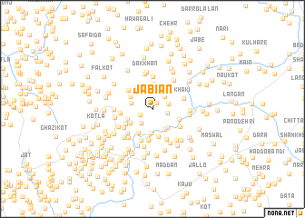
Jabian (North-West Frontier, Pakistan)Jabian is a town in the North-West Frontier region of Pakistan. An overview map of the region around Jabian is displayed below.
regional and 3d topo map of Jabian, Pakistan ::
Jabian airports ::
The nearest airport is MFG - Muzaffarabad, located 38.1 km east of Jabian.
Other airports nearby include SDT - Saidu Sharif (83.1 km north west), ISB - Islamabad Chaklala (85.7 km south), RAZ - Rawala Kot Rawalakot (88.0 km south east), PEW - Peshawar Intl (152.4 km west), Nearby towns ::
Nilaur (0.9km north east) //
Sanjliāla (1.5km south west) //
Jang (1.6km east) //
Hāri Maira (1.8km east) //
Lihāl (2.0km north east) //
Darwesh (2.0km south west) //
Fithi (2.2km north) //
Chinihāl (2.3km west) //
Thāthi (2.6km north west) //
Khiliān Haria (2.8km south east) //
Khabbe (2.9km north) //
Nawa Shahr (2.9km south) //
Mālkāni (2.8km south east) //
Susal (3.1km north) //
Langh (2.8km north west) //
Thākar Maira (2.9km south west) //
Chechiān Bānda (2.8km south west) //
Ruria (3.3km south west) //
Bhirina (3.4km south) //
Kheriān (2.9km south east) //
Jabba (3.5km south) //
Pathān Seri (3.3km south west) //
Galiān (3.4km north west) //
Gujrān (3.9km south) //
Jhāmra (4.0km north) //
Bāndi Mīra (3.5km south east) //
Bhojdarra (3.3km west) //
Khāki (3.4km east) //
Tsrehri (4.0km south) //
[all distances 'as the bird flies' and approximate] 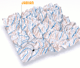 Places with similar names to Jabian, Pakistan ::
Disclaimer :: Information on this page comes without warranty of any kind |
||
|
Where is Jabian? Elevation and coordinates ::
Latitude (lat): 34°23'20"N Longitude (lon): 73°5'55"E
Elevation (approx.): 920m (map arrows pan, magnifying glasses zoom) |
||
|
Visiting Jabian? Hotel/Accommodation ::
Book a hotel in Jabian Travel Guide ::
Buy a travel guide for Pakistan rental cars ::
car rental offers GPS waypoint ::
download a GPX waypoint (PoI) of Jabian for your GPS receiver
|
||