|
search place name
|
||
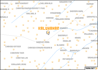
Kalu Wāhar (Punjab, Pakistan)Kalu Wāhar is a town in the Punjab region of Pakistan. An overview map of the region around Kalu Wāhar is displayed below.
regional and 3d topo map of Kalu Wāhar, Pakistan ::
Kalu Wāhar airports ::
The nearest airport is LYP - Faisalabad Intl, located 92.0 km north east of Kalu Wāhar.
Other airports nearby include MUX - Multan Intl (106.3 km south west), Nearby towns ::
Pirepur (1.7km north) //
Ladhāi (2.5km south west) //
Nawāda (3.4km south east) //
Jakkowāl (4.0km north) //
Shorkot Road (4.3km south west) //
Khawāja Bāju (4.3km south east) //
Chak Four Hundred Twelve (4.0km west) //
Nai Ābādi (4.5km west) //
Khamīsa (5.4km north) //
Wains Awān (4.8km east) //
Sherāpur (4.8km east) //
Nawān Hoshiārpur (5.4km north east) //
Jakkowāl (5.7km north) //
Chak Seven Hundred One A (6.0km south) //
Chak Four Hundred Eleven (6.0km north west) //
Chak Four Hundred Ninety-seven (5.9km north west) //
Aligarh (6.3km south east) //
Chak Seven Hundred One B (6.6km south west) //
Nūrpur (6.2km east) //
Mauju Mazārah (6.8km north east) //
Pindori Bibi (7.6km north) //
Rāhelān (7.0km south east) //
Chak Four Hundred Ninety-eight (6.9km west) //
Kāluwāla (7.4km north west) //
Khānora (7.8km north) //
Chak Four Hundred Ninety-six (7.6km north west) //
Khīkha (7.2km south east) //
Basti Chetanwāla (7.6km west) //
Chak Five Hundred Five (8.7km north) //
[all distances 'as the bird flies' and approximate] 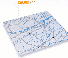 Places with similar names to Kalu Wāhar, Pakistan ::
// Galwehera (LK)
Disclaimer :: Information on this page comes without warranty of any kind |
||
|
Where is Kalu Wāhar? Elevation and coordinates ::
Latitude (lat): 30°49'5"N Longitude (lon): 72°16'10"E
Elevation (approx.): 145m (map arrows pan, magnifying glasses zoom) |
||
|
Visiting Kalu Wāhar? Hotel/Accommodation ::
Book a hotel in Kalu Wāhar Travel Guide ::
Buy a travel guide for Pakistan rental cars ::
car rental offers GPS waypoint ::
download a GPX waypoint (PoI) of Kalu Wāhar for your GPS receiver
|
||