|
search place name
|
||
Kamālewāla (Punjab, Pakistan)Kamālewāla is a town in the Punjab region of Pakistan. An overview map of the region around Kamālewāla is displayed below.
regional and 3d topo map of Kamālewāla, Pakistan ::

Kamālewāla airports ::
The nearest airport is RYK - Rahim Yar Khan Sheikh Zayed, located 73.2 km south west of Kamālewāla.
Other airports nearby include SUL - Sui (158.7 km west), MUX - Multan Intl (159.7 km north east), JSA - Jaisalmer (220.3 km south), SKZ - Sukkur (233.2 km south west), Nearby towns ::
Chak One Hundred Seventeen (1.7km south east) //
Saide Khān Gopāng (1.7km south west) //
Nalāh Musāni (1.6km north west) //
Chak One Hundred Twenty-seven (1.9km north east) //
Jām Banna (1.9km east) //
Jurāni (2.4km south west) //
Bohar (2.6km north east) //
Kohāwar (2.8km north east) //
Gasoriān (3.1km north) //
Chāh Adanwāla (3.0km north west) //
Mughrāni (2.9km north west) //
Mazārwāli (3.4km south) //
Pakka Lārān (3.1km west) //
Godewāla Kharah (3.5km south east) //
Hote Khān Gopāng (3.7km south west) //
Jung Bilāwal (4.0km north) //
Harūnābād (3.6km south east) //
Banat da Khu (4.1km north) //
Dāndli Naich (4.0km north west) //
Husainābād (4.2km south) //
Khokhar (3.8km east) //
Kotla Daulat (4.1km north west) //
Chak One Hundred Twenty-nine (4.2km north east) //
Chak One Hundred Twenty-five (4.4km south east) //
Malhāni (4.8km north) //
Sunnatābād (4.7km south west) //
Basti Kurāi (4.9km south west) //
Hatam Khān (5.2km north) //
Luamān Lār (4.9km south east) //
[all distances 'as the bird flies' and approximate] 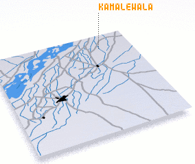 Places with similar names to Kamālewāla, Pakistan ::
// Kimbulawela (LK)
// Kumbalwala (LK)
// Kumbalwela (LK)
// Kumbalwella (LK)
// Gumalwāla (PK)
// Gummalwāla (PK)
// Kamalwāla (PK)
// Kamālwāla (PK)
// Kamālwāla (PK)
// Kamālwāla (PK)
Disclaimer :: Information on this page comes without warranty of any kind |
||
|
Where is Kamālewāla? Elevation and coordinates ::
Latitude (lat): 28°52'30"N Longitude (lon): 70°46'50"E
Elevation (approx.): 91m (map arrows pan, magnifying glasses zoom) |
||
|
Visiting Kamālewāla? Hotel/Accommodation ::
Book a hotel in Kamālewāla Travel Guide ::
Buy a travel guide for Pakistan rental cars ::
car rental offers GPS waypoint ::
download a GPX waypoint (PoI) of Kamālewāla for your GPS receiver
|
||