|
search place name
|
||
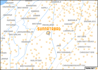
Sunnatābād (Punjab, Pakistan)Sunnatābād is a town in the Punjab region of Pakistan. An overview map of the region around Sunnatābād is displayed below.
regional and 3d topo map of Sunnatābād, Pakistan ::
Sunnatābād airports ::
The nearest airport is RYK - Rahim Yar Khan Sheikh Zayed, located 68.6 km south west of Sunnatābād.
Other airports nearby include SUL - Sui (155.4 km west), MUX - Multan Intl (164.3 km north east), JSA - Jaisalmer (216.6 km south), SKZ - Sukkur (228.8 km south west), Nearby towns ::
Basti Kurāi (0.9km north west) //
Hote Khān Gopāng (1.1km north) //
Basti Hāji Rahīm Bakhsh (1.3km south east) //
Basti Ārāīn (1.6km south) //
Mazārwāli (1.7km east) //
Basti Kandani (1.9km south east) //
Jurāni (2.3km north east) //
Basti Ther Posti (2.7km south) //
Basti Tarkhān (2.9km south) //
Pakka Lārān (2.9km north) //
Saide Khān Gopāng (3.0km north east) //
Basti Ahmad Bakhsh Lār (3.6km south west) //
Husainābād (3.5km east) //
Chak One Hundred Seventeen (4.1km north east) //
Kamālewāla (4.7km north east) //
Godewāla Kharah (4.4km east) //
Nalāh Musāni (5.0km north) //
Dar Khān (4.6km north west) //
Basti Ahmad Lār (5.3km south) //
Mughrāni (5.3km north) //
Basti Kaliār (5.2km south) //
Chak One Hundred - four (4.7km west) //
Havell Gharīb Shāh (5.2km south west) //
Chācharān (5.1km south east) //
Basti Kālu Khān (5.0km south east) //
Chak One Hundred -six (5.2km south west) //
Basti Mari (5.3km north west) //
Basti Gullān Lār (5.8km south) //
Jummawāla (5.2km east) //
[all distances 'as the bird flies' and approximate]  Places with similar names to Sunnatābād, Pakistan ::
// Sand Bed (US)
// Cennetabat (TR)
// Zandābād (IR)
// Saint-Abit (FR)
// Saint-Béat (FR)
// Saint-Thibaut (FR)
// Saint-Thiébaud (FR)
// Saint-Thibaut (FR)
Disclaimer :: Information on this page comes without warranty of any kind |
||
|
Where is Sunnatābād? Elevation and coordinates ::
Latitude (lat): 28°50'25"N Longitude (lon): 70°45'10"E
Elevation (approx.): 89m (map arrows pan, magnifying glasses zoom) |
||
|
Visiting Sunnatābād? Hotel/Accommodation ::
Book a hotel in Sunnatābād Travel Guide ::
Buy a travel guide for Pakistan rental cars ::
car rental offers GPS waypoint ::
download a GPX waypoint (PoI) of Sunnatābād for your GPS receiver
|
||