|
search place name
|
||
Karāmdād (Punjab, Pakistan)Karāmdād is a town in the Punjab region of Pakistan. An overview map of the region around Karāmdād is displayed below.
regional and 3d topo map of Karāmdād, Pakistan ::

Karāmdād airports ::
The nearest airport is SKZ - Sukkur, located 59.0 km north west of Karāmdād.
Other airports nearby include MJD - Moenjodaro (108.4 km west), SUL - Sui (141.6 km north), RYK - Rahim Yar Khan Sheikh Zayed (152.2 km north east), WNS - Nawabshah (152.7 km south west), Nearby towns ::
Shāhīla (0.4km south east) //
Shāhīlo (1.2km north west) //
Sumreji (1.7km north) //
Sāpro Tar (3.1km west) //
Sāpro (3.2km west) //
Mehrwāri (3.7km north) //
Gulālwāro (5.5km north east) //
Khāraro (6.5km west) //
Ganji (7.3km north east) //
Miāno (7.3km south east) //
Irki (7.1km east) //
Sādya (7.8km east) //
Rāhowāri (9.2km south west) //
Sudanwāro Goth (9.3km north west) //
Sājan Faqīr (9.9km south west) //
Deararo (10.2km north west) //
Lānerywāri (10.7km south west) //
Lānerywāri (11.0km south west) //
[all distances 'as the bird flies' and approximate] 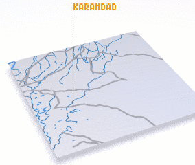 Places with similar names to Karāmdād, Pakistan ::
// Gramadata (BG)
// Kormododo (TD)
// Gurumaditta (LK)
// Keur Madoudia (SN)
// Karīmdād (PK)
// Karīmdād (PK)
// Karimdād (PK)
Disclaimer :: Information on this page comes without warranty of any kind |
||
|
Where is Karāmdād? Elevation and coordinates ::
Latitude (lat): 27°22'6"N Longitude (lon): 69°14'18"E
Elevation (approx.): 60m (map arrows pan, magnifying glasses zoom) |
||
|
Visiting Karāmdād? Hotel/Accommodation ::
Book a hotel in Karāmdād Travel Guide ::
Buy a travel guide for Pakistan rental cars ::
car rental offers GPS waypoint ::
download a GPX waypoint (PoI) of Karāmdād for your GPS receiver
|
||