|
search place name
|
||
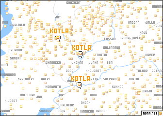
Kotla (North-West Frontier, Pakistan)Kotla is a town in the North-West Frontier region of Pakistan. An overview map of the region around Kotla is displayed below.
regional and 3d topo map of Kotla, Pakistan ::
Kotla airports ::
The nearest airport is MFG - Muzaffarabad, located 47.1 km east of Kotla.
Other airports nearby include ISB - Islamabad Chaklala (70.9 km south), RAZ - Rawala Kot Rawalakot (85.5 km south east), SDT - Saidu Sharif (86.7 km north west), PEW - Peshawar Intl (140.7 km west), Nearby towns ::
Barīla Khurd (1.1km north) //
Seri (1.3km north west) //
Chikar Bāhiān Kalān (1.3km east) //
Barīla Kalān (1.5km north east) //
Dheri (1.8km north west) //
Jhokān (2.1km south) //
Chinjar Kot (1.9km west) //
Katgirān (2.4km north east) //
Kund (2.4km north west) //
Dhamman (2.3km north west) //
Doga (2.5km north west) //
Kharsāl (2.7km north) //
Kamila (2.3km east) //
Jasgirān Bāla (2.3km west) //
Jasgirān Pāin (2.3km west) //
Nakka (2.8km north) //
Chikar Bāhiān Khurd (2.5km east) //
Sāwan Maira (3.3km north) //
Kashmīrpāni (3.4km north) //
Chamhatti (3.1km south east) //
Junha (3.1km south east) //
Palsala (3.1km south west) //
Lolgirān (3.6km north east) //
Batal (3.2km west) //
Chorgirān (3.9km south) //
Kangar Utla (3.9km south) //
Kangar Tarla (3.9km south) //
Dheri (4.2km north) //
Khiliāla (4.1km north) //
[all distances 'as the bird flies' and approximate] 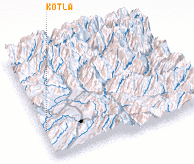 Places with similar names to Kotla, Pakistan ::
Disclaimer :: Information on this page comes without warranty of any kind |
||
|
Where is Kotla? Elevation and coordinates ::
Latitude (lat): 34°15'5"N Longitude (lon): 73°0'30"E
Elevation (approx.): 592m (map arrows pan, magnifying glasses zoom) |
||
|
Visiting Kotla? Hotel/Accommodation ::
Book a hotel in Kotla Travel Guide ::
Buy a travel guide for Pakistan rental cars ::
car rental offers GPS waypoint ::
download a GPX waypoint (PoI) of Kotla for your GPS receiver
|
||