|
search place name
|
||
Kot Siāl (Punjab, Pakistan)Kot Siāl is a town in the Punjab region of Pakistan. An overview map of the region around Kot Siāl is displayed below.
regional and 3d topo map of Kot Siāl, Pakistan ::

Kot Siāl airports ::
The nearest airport is LYP - Faisalabad Intl, located 88.6 km north west of Kot Siāl.
Other airports nearby include LHE - Lahore Allama Iqbal Intl (92.9 km north east), ATQ - Amritsar (134.2 km north east), IXJ - Jammu (223.5 km north east), IXP - Pathankot (232.1 km north east), Nearby towns ::
Chak Twenty-One A L (0.1km west) //
Chak Twenty-two-One A L (1.7km south east) //
Chak Twenty-five-One A L (2.6km south west) //
Chak Twenty A One A L (2.8km south west) //
Lūhriānwāla (2.8km north east) //
Chak Twenty A One A L (3.3km south) //
Landiānwāla (3.1km east) //
Chak Eighteen-One A L (3.5km north west) //
Chak Twenty-four-One A L (3.9km south) //
Kot Ahmad (4.0km south east) //
Chak Seventeen-One A L (4.0km north west) //
Chak Nineteen-One A L (3.8km west) //
Jodh Singhwāla (4.9km north) //
Chak Twenty-eight-One A L (4.5km south west) //
Dhāna (5.0km north east) //
Thatta Risālu (5.3km south) //
Ghuriānwāla (4.8km north east) //
Tilānwāla (4.6km east) //
Umrābād (5.4km north) //
Wān Rādha Rām (5.6km north) //
Chak Sixteen-One A L (5.0km west) //
Chak Twenty-nine-One A L (5.5km south west) //
Chak Twenty-six-One A L (6.1km south west) //
Chak Six-One A L (6.1km north west) //
Muhammadpura (6.4km south) //
Husaingarh (6.0km south east) //
Būlegarhi (6.0km north east) //
Rori (6.0km east) //
Rori (6.1km east) //
[all distances 'as the bird flies' and approximate] 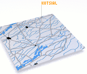 Places with similar names to Kot Siāl, Pakistan ::
// Gatchel (US)
// Kitchel (US)
// KuTshulu (ZA)
// Kotchila (RU)
// Kitts Hill (US)
// Gads Hill (US)
// Kitchell (US)
// Kitts Hill (US)
// Catchall (US)
// Gotchélé (CF)
Disclaimer :: Information on this page comes without warranty of any kind |
||
|
Where is Kot Siāl? Elevation and coordinates ::
Latitude (lat): 30°54'0"N Longitude (lon): 73°45'0"E
Elevation (approx.): 191m (map arrows pan, magnifying glasses zoom) |
||
|
Visiting Kot Siāl? Hotel/Accommodation ::
Book a hotel in Kot Siāl Travel Guide ::
Buy a travel guide for Pakistan rental cars ::
car rental offers GPS waypoint ::
download a GPX waypoint (PoI) of Kot Siāl for your GPS receiver
|
||