|
search place name
|
||
Lāhri Kili (Balochistān, Pakistan)Lāhri Kili is a town in the Balochistān region of Pakistan. An overview map of the region around Lāhri Kili is displayed below.
regional and 3d topo map of Lāhri Kili, Pakistan ::

Lāhri Kili airports ::
The nearest airport is SUL - Sui, located 153.6 km south of Lāhri Kili.
Other airports nearby include PZH - Zhob (168.0 km north east), UET - Quetta (176.5 km west), RYK - Rahim Yar Khan Sheikh Zayed (231.5 km south east), Nearby towns ::
Dādān Khān (3.1km north) //
Dīn Muhammad (3.4km north west) //
Mulgaroni Kili (3.5km north east) //
Sadr Chīna Kili (3.9km north) //
Faizullāh Shahr (4.0km north east) //
Dallo (4.2km north west) //
Marpāni Shahr (4.6km north west) //
Ismāīl Shahr (4.7km north west) //
Fateh Kili (5.5km north) //
Semāni Shahr (5.6km north west) //
Hazār Shahr (5.9km north west) //
Pazha (9.0km south) //
[all distances 'as the bird flies' and approximate] 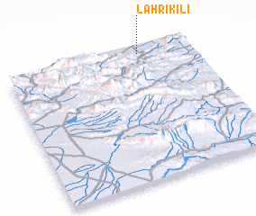 Places with similar names to Lāhri Kili, Pakistan ::
// Liergl (AT)
// Loreggiola (IT)
// Louriçal (PT)
// Lauragali (LV)
// Loriguilla (ES)
// Lār Qila (PK)
// Lora Kili (PK)
// Lora Kili (PK)
// Larquillo (PE)
// La Argolla (NI)
Disclaimer :: Information on this page comes without warranty of any kind |
||
|
Where is Lāhri Kili? Elevation and coordinates ::
Latitude (lat): 29°58'40"N Longitude (lon): 68°44'30"E
Elevation (approx.): 931m (map arrows pan, magnifying glasses zoom) |
||
|
Visiting Lāhri Kili? Hotel/Accommodation ::
Book a hotel in Lāhri Kili Travel Guide ::
Buy a travel guide for Pakistan rental cars ::
car rental offers GPS waypoint ::
download a GPX waypoint (PoI) of Lāhri Kili for your GPS receiver
|
||