|
search place name
|
||
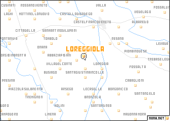
Loreggiola (Italy)Loreggiola is a town in Italy. An overview map of the region around Loreggiola is displayed below.
regional and 3d topo map of Loreggiola, Italy ::
Loreggiola airports ::
The nearest airport is QPA - Padova, located 23.1 km south of Loreggiola.
Other airports nearby include TSF - Treviso (23.6 km east), VIC - Vicenza (29.1 km west), VCE - Venice Venezia Tessera (36.8 km east), AVB - Aviano Ab (Pagliano E Gori) (72.3 km north east), Nearby towns ::
Borghetto (1.3km west) //
Carpane (1.9km north) //
Fratte (1.9km south) //
Santa Giustina in Colle (3.7km south) //
Loreggia (3.2km south east) //
Casa Dante (3.2km north west) //
Camposampiero (4.5km south east) //
Abbazia Pisani (3.9km west) //
Villa del Conte (4.3km south west) //
Brentanella (5.4km north east) //
Le Caselle (7.5km south) //
Castelfranco Veneto (7.5km north) //
San Martino di Lupari (6.8km north west) //
Resana (6.4km north east) //
Tombolo (6.4km north west) //
Arsego (7.9km south) //
Busiago (6.4km south west) //
Borgoricco (9.0km south east) //
Salvatronda (9.0km north east) //
[all distances 'as the bird flies' and approximate] 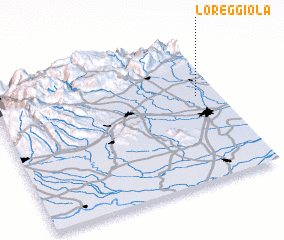 Places with similar names to Loreggiola, Italy ::
// Liergl (AT)
// Louriçal (PT)
// Lauragali (LV)
// Loriguilla (ES)
// Lāhri Kili (PK)
// Lār Qila (PK)
// Lora Kili (PK)
// Lora Kili (PK)
// Larquillo (PE)
// La Argolla (NI)
Disclaimer :: Information on this page comes without warranty of any kind |
||
|
Where is Loreggiola? Elevation and coordinates ::
Latitude (lat): 45°36'0"N Longitude (lon): 11°54'0"E
Elevation (approx.): 25m (map arrows pan, magnifying glasses zoom) |
||
|
Visiting Loreggiola? Hotel/Accommodation ::
Book a hotel in Loreggiola Travel Guide ::
Buy a travel guide for Italy rental cars ::
car rental offers GPS waypoint ::
download a GPX waypoint (PoI) of Loreggiola for your GPS receiver
|
||