|
search place name
|
||
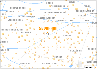
Sevo Khān (Sind, Pakistan)Sevo Khān is a town in the Sind region of Pakistan. An overview map of the region around Sevo Khān is displayed below.
regional and 3d topo map of Sevo Khān, Pakistan ::
Sevo Khān airports ::
The nearest airport is SUL - Sui, located 34.6 km north of Sevo Khān.
Other airports nearby include SKZ - Sukkur (74.6 km south), RYK - Rahim Yar Khan Sheikh Zayed (117.6 km east), MJD - Moenjodaro (145.0 km south west), JSA - Jaisalmer (238.8 km south east), Nearby towns ::
Goth Kamāl Khān (0.8km north) //
Muhammad Hayāt Bugti (1.3km south) //
Yār Muhammad (1.4km west) //
Yaqūb Khān (1.6km south) //
Gul Muhammad Jakrāni (1.6km south) //
Goth Chīl (1.7km west) //
Muhammad Hayāt Brāhui (1.8km north east) //
Farayo (1.8km south west) //
Ellāhi Bakhsh (1.9km north east) //
Muhammad Jabbār Khosa (2.5km north east) //
Sher Dil (2.4km south east) //
Behrām Khān (2.5km south east) //
Raza Muhammad Khosa (2.8km south west) //
Rājo Gola (2.9km north east) //
Arbāb Khān (2.8km east) //
Nūr Muhammad Khosa (3.3km south west) //
Amīr Bakhsh Isāl (3.3km south east) //
Jangou Isāl (3.5km south west) //
Goth Imām Bakhsh (3.4km south west) //
Goth Mehar Māri (3.7km north west) //
Raza Muhammad (3.7km east) //
Chāchar (4.4km south east) //
Goth Totapur (4.4km north east) //
Goth Rāna Bhalo (4.1km west) //
Muhammad Azim Khosa (4.3km south east) //
Khair Bakhsh Gabol (4.6km south west) //
Hazūr Bakhsh Gishkori (4.5km north west) //
Ālam Khān Khosa (4.8km south) //
Sohbat Khān Bājkāni (4.9km south) //
[all distances 'as the bird flies' and approximate] 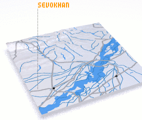 Places with similar names to Sevo Khān, Pakistan ::
// Svakhino (RU)
// Şafā Khāneh (IR)
// Şafī Khānī (IR)
// Şafī Khūn (IR)
// Şāfkhūnī (IR)
// Sāfi Khān (PK)
// Sofi Khān (PK)
// Sivokhino (RU)
Disclaimer :: Information on this page comes without warranty of any kind |
||
|
Where is Sevo Khān? Elevation and coordinates ::
Latitude (lat): 28°20'40"N Longitude (lon): 69°4'50"E
Elevation (approx.): 68m (map arrows pan, magnifying glasses zoom) |
||
|
Visiting Sevo Khān? Hotel/Accommodation ::
Book a hotel in Sevo Khān Travel Guide ::
Buy a travel guide for Pakistan rental cars ::
car rental offers GPS waypoint ::
download a GPX waypoint (PoI) of Sevo Khān for your GPS receiver
|
||