|
search place name
|
||
Shāri Kili (North-West Frontier, Pakistan)Shāri Kili is a town in the North-West Frontier region of Pakistan. An overview map of the region around Shāri Kili is displayed below.
regional and 3d topo map of Shāri Kili, Pakistan ::

Shāri Kili airports ::
The nearest airport is PEW - Peshawar Intl, located 139.5 km north east of Shāri Kili.
Other airports nearby include JAA - Jalalabad (154.9 km north), PZH - Zhob (211.1 km south west), KBL - Kabul Intl (214.8 km north west), SDT - Saidu Sharif (258.6 km north east), Nearby towns ::
Khanif Kili (0.3km south) //
Bashīr Kili (0.6km south west) //
Gul Hasan (0.6km north west) //
Bābu Kili (1.0km south) //
Umi Khān (1.0km north west) //
Kotkai Sadar Shāh (1.1km west) //
Sargul Kalle (1.3km south) //
Sorang (1.3km west) //
Miānji Khel (1.5km west) //
Bannu Cantonment (1.5km south east) //
Bahādur Kalle (1.8km south) //
Parez (1.6km south west) //
Ghulām Kili (1.9km north) //
Akbar Ali Khān (1.9km south) //
Idak Kili (1.7km west) //
Sadāt Madad Shah (1.9km north east) //
Badar Kili (2.1km south) //
Jahāngīr Kili (2.1km north east) //
Fort Edwardes (1.9km south east) //
Kachkotai Asad Khān (1.9km north east) //
Hindki (2.1km south west) //
Kotkai Khān Bādshāh (2.1km north west) //
Pīrān Kili (2.1km north west) //
Lālozai (2.2km north east) //
Samand Khān (2.1km south west) //
Bhittanni Kili (2.3km south east) //
Jabār Kili (2.4km south) //
Shaikhān (2.3km south west) //
Mīr Alam (2.5km north east) //
[all distances 'as the bird flies' and approximate] 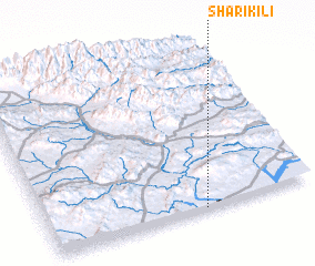 Places with similar names to Shāri Kili, Pakistan ::
// Shyrokyy Luh (UA)
// Charkli (RU)
// Charīklū (IR)
// Chārqolī (IR)
// Charāikol (BD)
// Chāraikola (BD)
// Char Goāli (BD)
// Char Kāli (BD)
// Char Kāli (BD)
// Churigualla (CL)
Disclaimer :: Information on this page comes without warranty of any kind |
||
|
Where is Shāri Kili? Elevation and coordinates ::
Latitude (lat): 33°0'20"N Longitude (lon): 70°35'12"E
Elevation (approx.): 391m (map arrows pan, magnifying glasses zoom) |
||
|
Visiting Shāri Kili? Hotel/Accommodation ::
Book a hotel in Shāri Kili Travel Guide ::
Buy a travel guide for Pakistan rental cars ::
car rental offers GPS waypoint ::
download a GPX waypoint (PoI) of Shāri Kili for your GPS receiver
|
||