|
search place name
|
||
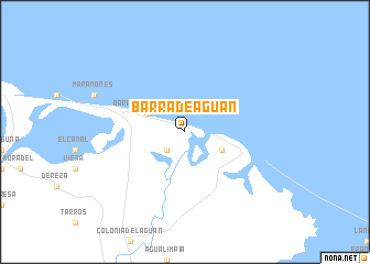
Barra de Aguán (Colón, Honduras)Barra de Aguán is a town in the Colón region of Honduras. An overview map of the region around Barra de Aguán is displayed below.
regional and 3d topo map of Barra de Aguán, Honduras ::
Barra de Aguán airports ::
The nearest airport is GJA - Guanaja, located 55.6 km north of Barra de Aguán.
Other airports nearby include RTB - Roatan Juan Manuel Galvez Intl (91.3 km north west), LCE - La Ceiba Goloson Intl (120.7 km west), TEA - Tela (186.0 km west), TGU - Tegucigalpa Toncontin Intl (263.4 km south west), Nearby towns ::
Vuelta Grande (2.6km south west) //
Barra de Chapagua (4.0km north west) //
Santa Rosa de Aguán (4.0km south east) //
[all distances 'as the bird flies' and approximate]  Places with similar names to Barra de Aguán, Honduras ::
// Burtigny (CH)
// Bordogna (IT)
// Bartków Nowy (PL)
// Bartkūnai (LT)
// Bartkūnai (LT)
// Briţcani (RO)
// Bardagon (RU)
// Borodkino (RU)
// Bordakān (IR)
// Bārttakona (BD)
Disclaimer :: Information on this page comes without warranty of any kind |
||
|
Where is Barra de Aguán? Elevation and coordinates ::
Latitude (lat): 15°58'0"N Longitude (lon): 85°45'0"W
Elevation (approx.): 6m (map arrows pan, magnifying glasses zoom) |
||
|
Visiting Barra de Aguán? Hotel/Accommodation ::
Book a hotel in Barra de Aguán Travel Guide ::
Buy a travel guide for Honduras rental cars ::
car rental offers GPS waypoint ::
download a GPX waypoint (PoI) of Barra de Aguán for your GPS receiver
|
||