|
search place name
|
||
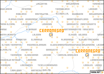
Cerro Negro (Copán, Honduras)Cerro Negro is a town in the Copán region of Honduras. An overview map of the region around Cerro Negro is displayed below.
regional and 3d topo map of Cerro Negro, Honduras ::
Cerro Negro airports ::
The nearest airport is SAP - San Pedro Sula La Mesa Intl, located 126.4 km north east of Cerro Negro.
Other airports nearby include SAL - San Salvador El Salvador Intl (158.3 km south), CBV - Coban (171.8 km north west), GUA - Guatemala City La Aurora (174.5 km west), TEA - Tela (186.1 km north east), Nearby towns ::
Bañaderos (0.0km north) //
Las Peñas (0.0km north) //
Las Delicias (1.9km north) //
Cañón de Barbascal (1.8km east) //
Pacayal (1.8km east) //
Debajiados (1.9km south) //
Aldea Nueva (2.6km north east) //
Mar Azul (2.6km south east) //
Candelillo (3.7km north) //
Cedro Chiboloso (4.0km north east) //
Las Mesas (4.1km north west) //
El Descombro (4.1km south east) //
San José de las Quebraditas (5.2km north east) //
La Lima (5.2km south east) //
Irayol (5.4km west) //
La Leona (5.4km west) //
San Agustín (5.6km south) //
Las Pavas (5.6km north) //
El Carrizal (5.8km south) //
Piedras Coloradas (5.8km north) //
El Naranjo (5.7km west) //
El Cile (5.7km west) //
La Ruda (5.7km east) //
Plan Grande (5.7km east) //
Vara de Cohete (5.8km north) //
Plan del Naranjo (6.6km north east) //
Bálsamo (6.6km north east) //
Piedras Coloradas (6.5km south west) //
El Planón (6.5km south west) //
[all distances 'as the bird flies' and approximate] 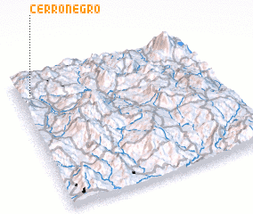 Places with similar names to Cerro Negro, Honduras ::
// Serra Negra (BR)
// Serra Negra (BR)
// Serra Negra (BR)
// Serra Negra (BR)
// Serra Negra (BR)
// Cerro Negro (PA)
// Cerro Negro (PA)
// Sŭrnegor (BG)
// Cernicari (RO)
// Srīnagar (BD)
Disclaimer :: Information on this page comes without warranty of any kind |
||
|
Where is Cerro Negro? Elevation and coordinates ::
Latitude (lat): 14°52'0"N Longitude (lon): 88°56'0"W
Elevation (approx.): 1412m (map arrows pan, magnifying glasses zoom) |
||
|
Visiting Cerro Negro? Hotel/Accommodation ::
Book a hotel in Cerro Negro Travel Guide ::
Buy a travel guide for Honduras rental cars ::
car rental offers GPS waypoint ::
download a GPX waypoint (PoI) of Cerro Negro for your GPS receiver
|
||