|
search place name
|
||
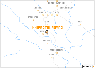
Khirbat al Bayḑāʼ (Aţ Ţafīlah, Jordan)Khirbat al Bayḑāʼ is a town in the Aţ Ţafīlah region of Jordan. An overview map of the region around Khirbat al Bayḑāʼ is displayed below.
regional and 3d topo map of Khirbat al Bayḑāʼ, Jordan ::
Khirbat al Bayḑāʼ airports ::
The nearest airport is BEV - Beer-sheba Teyman, located 101.7 km north west of Khirbat al Bayḑāʼ.
Other airports nearby include VDA - Ovda (111.7 km south west), AMM - Amman Queen Alia Intl (112.4 km north), ADJ - Amman Marka Intl (138.8 km north), AQJ - Aqaba King Hussein Intl (139.8 km south west), Nearby towns ::
Al Mi‘ţan (0.0km north) //
As Sil‘ (1.6km west) //
‘Ābil (3.7km north) //
Buşayrā (3.7km south) //
Aţ Ţafīlah (7.4km north) //
Ruwaym (7.6km north) //
Ad Duwaykhilah (7.6km north) //
An Namatah (7.3km north west) //
Al ‘Iş (8.1km north east) //
Ar Rashādīyah (8.1km south east) //
[all distances 'as the bird flies' and approximate] 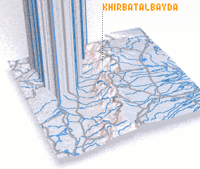 Places with similar names to Khirbat al Bayḑāʼ, Jordan ::
// Khirbat al Bayḑā (SY)
// Khirbat al Bayḑāʼ (SY)
Disclaimer :: Information on this page comes without warranty of any kind |
||
|
Where is Khirbat al Bayḑāʼ? Elevation and coordinates ::
Latitude (lat): 30°46'0"N Longitude (lon): 35°36'0"E
Elevation (approx.): 922m (map arrows pan, magnifying glasses zoom) |
||
|
Visiting Khirbat al Bayḑāʼ? Hotel/Accommodation ::
Book a hotel in Khirbat al Bayḑāʼ Travel Guide ::
Buy a travel guide for Jordan rental cars ::
car rental offers GPS waypoint ::
download a GPX waypoint (PoI) of Khirbat al Bayḑāʼ for your GPS receiver
|
||