|
search place name
|
||
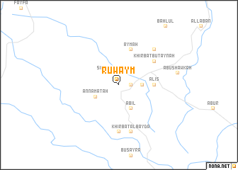
Ruwaym (Aţ Ţafīlah, Jordan)Ruwaym is a town in the Aţ Ţafīlah region of Jordan. An overview map of the region around Ruwaym is displayed below.
regional and 3d topo map of Ruwaym, Jordan ::
Ruwaym airports ::
The nearest airport is BEV - Beer-sheba Teyman, located 96.3 km north west of Ruwaym.
Other airports nearby include AMM - Amman Queen Alia Intl (106.0 km north), VDA - Ovda (116.9 km south west), ADJ - Amman Marka Intl (132.2 km north), AQJ - Aqaba King Hussein Intl (146.0 km south), Nearby towns ::
Aţ Ţafīlah (1.6km east) //
Şinifḩah (2.4km north west) //
Ad Duwaykhilah (3.2km east) //
An Namatah (3.7km south west) //
‘Ābil (4.0km south east) //
Al ‘Iş (4.8km east) //
‘Aymah (5.8km north) //
Khirbat Buţaynah (6.0km north east) //
As Sil‘ (7.4km south) //
Khirbat al Bayḑāʼ (7.6km south) //
Al Mi‘ţan (7.6km south) //
Khirbat Majādil (7.3km north east) //
[all distances 'as the bird flies' and approximate] 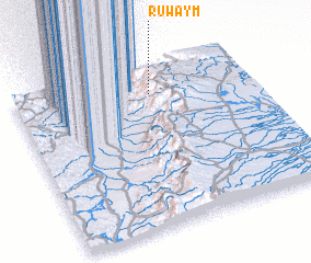
Disclaimer :: Information on this page comes without warranty of any kind |
||
|
Where is Ruwaym? Elevation and coordinates ::
Latitude (lat): 30°50'0"N Longitude (lon): 35°35'0"E
Elevation (approx.): 813m (map arrows pan, magnifying glasses zoom) |
||
|
Visiting Ruwaym? Hotel/Accommodation ::
Book a hotel in Ruwaym Travel Guide ::
Buy a travel guide for Jordan rental cars ::
car rental offers GPS waypoint ::
download a GPX waypoint (PoI) of Ruwaym for your GPS receiver
|
||