|
search place name
|
||
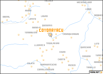
Coyonayacu (Cajamarca, Peru)Coyonayacu is a town in the Cajamarca region of Peru. An overview map of the region around Coyonayacu is displayed below.
regional and 3d topo map of Coyonayacu, Peru ::
Coyonayacu airports ::
The nearest airport is CIX - Chiclayo Capt Jose A Quinones Gonzales Intl, located 97.8 km south west of Coyonayacu.
Other airports nearby include PIU - Piura Capitan Fap Guillermo Concha Iberico (155.4 km north west), CHH - Chachapoyas (178.1 km east), TYL - Talara Capitan Montes (253.6 km north west), Nearby towns ::
La Divina (1.2km south east) //
Alizo (1.7km east) //
Hacienda Santa Lucía (1.9km north east) //
Mayque (1.9km north west) //
Queseras (3.3km north west) //
Trigal Pampa (3.4km south) //
Potrerio (4.4km south) //
Espino (5.1km south) //
Naranjo (5.7km north west) //
Lluspirca (5.8km south west) //
Laguna (6.1km south west) //
Ladino (6.9km north) //
Casas Quemadas (7.1km east) //
Yerbabuena (7.2km west) //
Paja Blanca (7.4km north west) //
Santa Rosa (7.5km south west) //
Cedro (7.8km south east) //
La Fato (8.6km north west) //
El Naranjo (8.8km south) //
Hacienda Huallabamba (9.1km south east) //
Carrizal (9.9km south west) //
Chirimoyo (10.0km north west) //
Muñuño (10.6km south east) //
Paipay (11.7km north west) //
[all distances 'as the bird flies' and approximate]  Places with similar names to Coyonayacu, Peru ::
// Kyonyaik (MM)
Disclaimer :: Information on this page comes without warranty of any kind |
||
|
Where is Coyonayacu? Elevation and coordinates ::
Latitude (lat): 5°59'14"S Longitude (lon): 79°27'3"W
Elevation (approx.): 2487m (map arrows pan, magnifying glasses zoom) |
||
|
Visiting Coyonayacu? Hotel/Accommodation ::
Book a hotel in Coyonayacu Travel Guide ::
Buy a travel guide for Peru rental cars ::
car rental offers GPS waypoint ::
download a GPX waypoint (PoI) of Coyonayacu for your GPS receiver
|
||