|
search place name
|
||
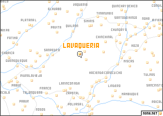
La Vaquería (Piura, Peru)La Vaquería is a town in the Piura region of Peru. An overview map of the region around La Vaquería is displayed below.
regional and 3d topo map of La Vaquería, Peru ::
La Vaquería airports ::
The nearest airport is PIU - Piura Capitan Fap Guillermo Concha Iberico, located 73.0 km west of La Vaquería.
Other airports nearby include TYL - Talara Capitan Montes (154.1 km west), TBP - Tumbes Pedro Canga (177.2 km north), CIX - Chiclayo Capt Jose A Quinones Gonzales Intl (187.2 km south), MCH - Machala General Manuel Serrano (202.5 km north), Nearby towns ::
Pampa Grande (1.2km east) //
Bordo Macho (1.7km north east) //
Jacanacas (5.2km east) //
Pie del Toro (6.5km south east) //
Quilpón (6.5km north) //
Chilinique (6.6km south east) //
Chinchinal (6.7km north east) //
San Pedro (6.7km west) //
Guayaquil (6.9km south) //
Hacienda Caracucho (7.2km south east) //
La Rinconada (7.4km south) //
Simiris (7.6km north) //
Algodonales (7.8km south east) //
San Jacinto (7.8km north) //
Hualtacal (7.9km west) //
Pavita (8.2km north west) //
Piedra Blanca (8.3km south west) //
El Puente (8.4km east) //
San Luis (8.5km south) //
Piedra Blanca (8.5km south west) //
Huacas (8.8km north east) //
Tuñali (8.9km north east) //
Monte de Los Padres (8.9km west) //
Boca Negra (9.1km south) //
Chungayo (10.3km north east) //
Franco Viejo (10.3km south west) //
Naranja (10.7km north west) //
Lindero (10.8km south east) //
Chapros (11.0km north west) //
[all distances 'as the bird flies' and approximate]  Places with similar names to La Vaquería, Peru ::
// La Figuera (ES)
// La Figuera (ES)
// La Vicaría (ES)
// Lo Figueroa (CL)
// La Figueroa (CO)
// La Vaquería (MX)
// La Vaquería (MX)
// La Viguería (MX)
// La Uvaquera (VE)
// La Vaquera (VE)
Disclaimer :: Information on this page comes without warranty of any kind |
||
|
Where is La Vaquería? Elevation and coordinates ::
Latitude (lat): 5°6'0"S Longitude (lon): 79°58'0"W
Elevation (approx.): 481m (map arrows pan, magnifying glasses zoom) |
||
|
Visiting La Vaquería? Hotel/Accommodation ::
Book a hotel in La Vaquería Travel Guide ::
Buy a travel guide for Peru rental cars ::
car rental offers GPS waypoint ::
download a GPX waypoint (PoI) of La Vaquería for your GPS receiver
|
||