|
search place name
|
||
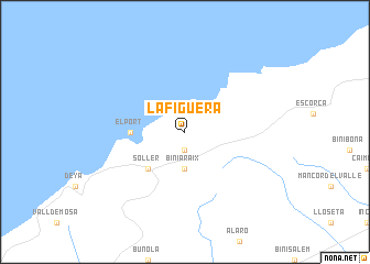
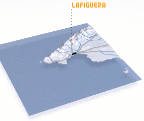
La Figuera (Islas Baleares, Spain)La Figuera is a town in the Islas Baleares region of Spain. An overview map of the region around La Figuera is displayed below.
regional and 3d topo map of La Figuera, Spain ::
La Figuera airports ::
The nearest airport is PMI - Palma De Mallorca (Son San Juan), located 27.6 km south of La Figuera.
Other airports nearby include MAH - Menorca (127.3 km east), IBZ - Ibiza (156.0 km south west), BCN - Barcelona (175.3 km north), REU - Reus (200.1 km north west), Nearby towns ::
 Places with similar names to La Figuera, Spain ::
// La Figuera (ES)
// La Vicaría (ES)
// Lo Figueroa (CL)
// La Figueroa (CO)
// La Vaquería (MX)
// La Vaquería (MX)
// La Viguería (MX)
// La Vaquería (PE)
// La Uvaquera (VE)
// La Vaquera (VE)
Disclaimer :: Information on this page comes without warranty of any kind |
||
|
Where is La Figuera? Elevation and coordinates ::
Latitude (lat): 39°48'0"N Longitude (lon): 2°44'0"E
Elevation (approx.): 655m (map arrows pan, magnifying glasses zoom) |
||
|
Visiting La Figuera? Hotel/Accommodation ::
Book a hotel in La Figuera Travel Guide ::
Buy a travel guide for Spain rental cars ::
car rental offers GPS waypoint ::
download a GPX waypoint (PoI) of La Figuera for your GPS receiver
|
||