|
search place name
|
||
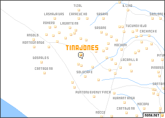
Tinajones (Lambayeque, Peru)Tinajones is a town in the Lambayeque region of Peru. An overview map of the region around Tinajones is displayed below.
regional and 3d topo map of Tinajones, Peru ::
Tinajones airports ::
The nearest airport is CIX - Chiclayo Capt Jose A Quinones Gonzales Intl, located 27.6 km south east of Tinajones.
Other airports nearby include PIU - Piura Capitan Fap Guillermo Concha Iberico (167.9 km north west), TRU - Trujillo Capitan Carlos Martinez De Pinillos (191.2 km south east), TYL - Talara Capitan Montes (263.6 km north west), Nearby towns ::
San Antonio (1.5km south) //
San Juan (1.5km south west) //
Valle Nuevo (2.9km south east) //
Huaca de Barro (3.1km north) //
Árbolsol (3.5km north west) //
El Carrizo (3.5km north east) //
Solecape (4.0km south) //
Chepito (4.3km north) //
La Laguna (4.6km north) //
El Pozo (5.1km east) //
Pueblo Nuevo (5.5km east) //
Cruz de Mediania (5.8km south west) //
Los Paches (5.9km north east) //
Río Hondo (6.0km south east) //
Fanupe (6.1km north west) //
Quemazón (6.1km north west) //
Santa Cruz de Médano (6.2km north) //
La Piedra (6.6km east) //
La Experimental (6.6km east) //
Cruz de Paredones (6.7km south) //
El Alto (6.7km north) //
Maravillas (6.8km north east) //
Cochineros (6.9km north west) //
Sasape (7.4km north east) //
La Calzada (7.5km east) //
Lagartera (7.6km north) //
La Pava (7.8km north east) //
La Playa (7.8km north east) //
Macnape (8.0km north west) //
[all distances 'as the bird flies' and approximate]  Places with similar names to Tinajones, Peru ::
// Taung-inzu (MM)
// Dungeness (US)
// Tinajones (PA)
// Tangenes (NO)
// Dungeness (US)
// Tinajones (PE)
// Tinajones (PE)
// Tinajones (PE)
// Donji Anići (HR)
Disclaimer :: Information on this page comes without warranty of any kind |
||
|
Where is Tinajones? Elevation and coordinates ::
Latitude (lat): 6°33'58"S Longitude (lon): 79°56'34"W
Elevation (approx.): 28m (map arrows pan, magnifying glasses zoom) |
||
|
Visiting Tinajones? Hotel/Accommodation ::
Book a hotel in Tinajones Travel Guide ::
Buy a travel guide for Peru rental cars ::
car rental offers GPS waypoint ::
download a GPX waypoint (PoI) of Tinajones for your GPS receiver
|
||