|
search place name
|
||
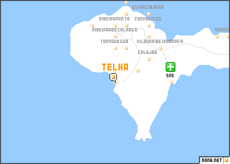
Telha (Cape Verde)Telha is a town in Cape Verde. An overview map of the region around Telha is displayed below.
regional and 3d topo map of Telha, Cape Verde ::
Telha airports ::
The nearest airport is SNE - Sao Nocolau Island Preguica, located 9.1 km east of Telha.
Other airports nearby include VXE - Sao Vicente Island Sao Pedro (79.1 km west), SID - Amilcar Cabral Intl (152.4 km east), BVC - Boa Vista Rabil (164.9 km east), MMO - Maio (199.0 km south east), Nearby towns ::
Tarrafal (0.0km north) //
Escada (1.9km north) //
Fontainhas (4.0km north east) //
Torno dʼÁgua (5.6km north) //
Ortelão (5.6km north) //
Palhal (5.8km north) //
Cachacinho (6.5km north east) //
Calejão (6.5km north east) //
Cabeçalinho (6.5km north east) //
Ribeira dos Calhaus (7.4km north) //
Queimadas (9.1km north east) //
Vila da Ribeira Brava (9.0km north east) //
[all distances 'as the bird flies' and approximate] 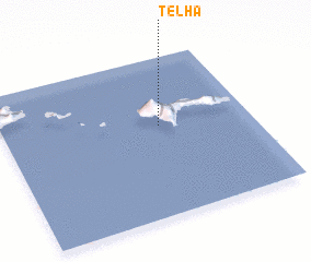 Places with similar names to Telha, Cape Verde ::
Disclaimer :: Information on this page comes without warranty of any kind |
||
|
Where is Telha? Elevation and coordinates ::
Latitude (lat): 16°34'0"N Longitude (lon): 24°22'0"W
Elevation (approx.): -32768m (map arrows pan, magnifying glasses zoom) |
||
|
Visiting Telha? Hotel/Accommodation ::
Book a hotel in Telha Travel Guide ::
Buy a travel guide for Cape Verde rental cars ::
car rental offers GPS waypoint ::
download a GPX waypoint (PoI) of Telha for your GPS receiver
|
||