|
search place name
|
||
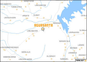
Agua Santa (Trujillo, Venezuela)Agua Santa is a town in the Trujillo region of Venezuela. An overview map of the region around Agua Santa is displayed below.
regional and 3d topo map of Agua Santa, Venezuela ::
Agua Santa airports ::
The nearest airport is VLV - Valera Dr Antonio Nicolas Briceno, located 21.5 km south east of Agua Santa.
Other airports nearby include BNS - Barinas (110.7 km south east), GUQ - Guanare (113.9 km south east), MRD - Merida Alberto Carnevalli (116.8 km south west), STB - Santa Barbara Del Zulia (152.5 km south west), Nearby towns ::
El Salto (2.7km north east) //
El Corozo (4.7km south west) //
La Bloquera (4.7km west) //
Agua Viva (5.0km north) //
El Araguaney (5.8km north) //
El Buey (6.4km north west) //
San Miguel (6.5km east) //
Las Cocuizas (7.1km south west) //
Las Adjuntas (7.2km east) //
El Dividive (8.5km south west) //
El Jagüito (8.8km north west) //
Jaguito (9.2km north west) //
La Picadora (12.1km north west) //
[all distances 'as the bird flies' and approximate]  Places with similar names to Agua Santa, Venezuela ::
// Aquasanta (IT)
// Agua Santa (CU)
// Agua Santa (SV)
// Agua Santa (PE)
// Agua Santa (PE)
// Agua Santa (PE)
// Agua Santa (PE)
// Agua Santa (VE)
// Agua Santa (VE)
// Agua Santa (VE)
Disclaimer :: Information on this page comes without warranty of any kind |
||
|
Where is Agua Santa? Elevation and coordinates ::
Latitude (lat): 9°31'0"N Longitude (lon): 70°40'0"W
Elevation (approx.): 162m (map arrows pan, magnifying glasses zoom) |
||
|
Visiting Agua Santa? Hotel/Accommodation ::
Book a hotel in Agua Santa Travel Guide ::
Buy a travel guide for Venezuela rental cars ::
car rental offers GPS waypoint ::
download a GPX waypoint (PoI) of Agua Santa for your GPS receiver
|
||