|
search place name
|
||
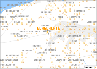
El Aguacate (Distrito Federal, Venezuela)El Aguacate is a town in the Distrito Federal region of Venezuela. An overview map of the region around El Aguacate is displayed below.
regional and 3d topo map of El Aguacate, Venezuela ::
El Aguacate airports ::
The nearest airport is CCS - Caracas Simon Bolivar Intl, located 13.6 km north of El Aguacate.
Other airports nearby include VLN - Valencia Arturo Michelena Intl (108.9 km west), PBL - Puerto Cabello General Bartolome Salom Intl (118.4 km west), VDP - Valle De La Pascua (177.1 km south east), SFH - San Felipe Sub Teniente Nestor Arias (194.4 km west), Nearby towns ::
El Hatico (0.7km north west) //
Dos Caminos (1.0km east) //
La Coromoto (1.0km east) //
El Carmen (1.3km south east) //
Antímano (1.8km south east) //
La Grama (2.1km south) //
El Gallo (2.5km north east) //
Urbanización Industrial La Yaguara (2.7km east) //
El Algodonal (2.8km east) //
Carapa (2.8km east) //
Tasajera (2.9km north west) //
Montalbancito (3.1km south east) //
Bella Vista (4.1km east) //
El Portachuelo (4.2km north east) //
Caricuao (4.4km south) //
Sagüino (4.6km west) //
Sabaneta (4.6km west) //
Vista Alegre (4.7km east) //
Propatria (4.8km north east) //
Montalban (4.8km south east) //
La Vega (4.8km east) //
La Elvira (5.3km south) //
El Pinar (5.8km east) //
Tacagua (5.9km north) //
Las Adjuntas (5.9km south west) //
Artigas (5.9km east) //
Santa Cruz (6.0km south east) //
Nueva Caracas (6.1km north east) //
Las Vegas (6.1km south east) //
[all distances 'as the bird flies' and approximate] 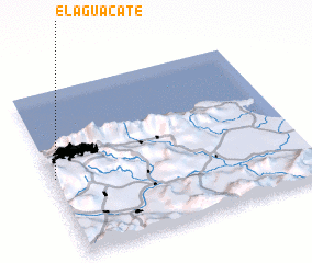 Places with similar names to El Aguacate, Venezuela ::
// El Ougagda (MA)
// El Aguacate (PA)
// El Aguacate (PA)
// El Aguacate (PA)
// El Aguacate (PA)
// El Aguacate (PA)
// El Cacaíto (PA)
// El Coquito (PA)
// El Coquito (PA)
// El Aguacate (CU)
Disclaimer :: Information on this page comes without warranty of any kind |
||
|
Where is El Aguacate? Elevation and coordinates ::
Latitude (lat): 10°28'50"N Longitude (lon): 66°59'30"W
Elevation (approx.): 1315m (map arrows pan, magnifying glasses zoom) |
||
|
Visiting El Aguacate? Hotel/Accommodation ::
Book a hotel in El Aguacate Travel Guide ::
Buy a travel guide for Venezuela rental cars ::
car rental offers GPS waypoint ::
download a GPX waypoint (PoI) of El Aguacate for your GPS receiver
|
||