|
search place name
|
||
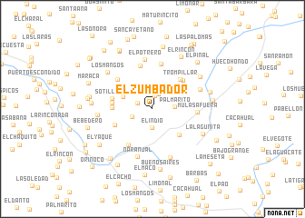
El Zumbador (Sucre, Venezuela)El Zumbador is a town in the Sucre region of Venezuela. An overview map of the region around El Zumbador is displayed below.
regional and 3d topo map of El Zumbador, Venezuela ::
El Zumbador airports ::
The nearest airport is CUM - Cumana Antonio Jose De Sucre, located 38.8 km north west of El Zumbador.
Other airports nearby include PMV - Porlamar Del Caribe Intl Gen Santiago Marino (72.5 km north), CUP - Carupano General Jose Francisco Bermudez (75.1 km north east), MUN - Maturin (93.7 km south east), BLA - Barcelona General Jose Antonio Anzoategui Intl (96.4 km west), Nearby towns ::
Macanillal (1.6km north) //
Peñas Negras (1.9km west) //
Palmarito Abajo (2.0km north) //
El Indio (2.3km south) //
Gallinero (2.6km west) //
Palmarito (2.7km east) //
Macanillal Afuera (3.0km north west) //
Bucaral (3.8km north east) //
Contador (3.9km west) //
El Picacho (4.5km south east) //
San Juanillo (4.9km west) //
Trompillar (4.9km north east) //
Pueblo Nuevo (4.9km west) //
Valle Grande (4.9km south west) //
Río Sotillo (5.0km west) //
Pata de Gallina (5.1km north east) //
El Sitio de Agua Blanca (5.3km south west) //
La Fortuna (5.5km north) //
Mulas Afuera (5.5km east) //
Las Vegas (5.6km north) //
Las Caras (5.6km north west) //
Naranjal (6.1km south) //
El Potrero (6.2km north) //
El Naranjo (6.2km north east) //
Corral Viejo (6.3km south) //
Paracua (6.7km west) //
La Lagunita (6.8km south east) //
Mulas Adentro (7.0km north east) //
Los Mangos (7.1km north west) //
[all distances 'as the bird flies' and approximate] 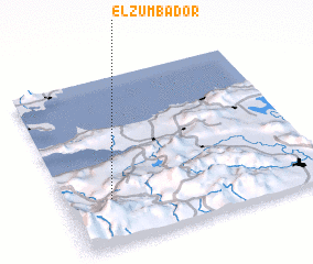 Places with similar names to El Zumbador, Venezuela ::
// El Asomadero (PA)
// El Asomadero (CO)
// El Asomadero (CO)
// El Zumbador (CO)
// El Sumidero (MX)
// El Zumbador (VE)
// El Zumbador (DO)
Disclaimer :: Information on this page comes without warranty of any kind |
||
|
Where is El Zumbador? Elevation and coordinates ::
Latitude (lat): 10°16'22"N Longitude (lon): 63°49'30"W
Elevation (approx.): 973m (map arrows pan, magnifying glasses zoom) |
||
|
Visiting El Zumbador? Hotel/Accommodation ::
Book a hotel in El Zumbador Travel Guide ::
Buy a travel guide for Venezuela rental cars ::
car rental offers GPS waypoint ::
download a GPX waypoint (PoI) of El Zumbador for your GPS receiver
|
||