|
search place name
|
||
Naranjal (Sucre, Venezuela)Naranjal is a town in the Sucre region of Venezuela. An overview map of the region around Naranjal is displayed below.
regional and 3d topo map of Naranjal, Venezuela ::

Naranjal airports ::
The nearest airport is CUM - Cumana Antonio Jose De Sucre, located 40.6 km north west of Naranjal.
Other airports nearby include PMV - Porlamar Del Caribe Intl Gen Santiago Marino (77.8 km north), CUP - Carupano General Jose Francisco Bermudez (79.9 km north east), MUN - Maturin (91.7 km south east), BLA - Barcelona General Jose Antonio Anzoategui Intl (93.8 km west), Nearby towns ::
El Sitio de Agua Blanca (1.8km north west) //
El Maco (2.4km south) //
Perfecto (2.7km south west) //
Buenos Aires (3.2km south east) //
Los Dos Rís (3.4km west) //
Los Chorros (3.8km south) //
El Indio (3.9km north east) //
Corral Viejo (3.9km east) //
El Cacho (4.1km south west) //
La Tigra (4.7km south east) //
Valle Grande (4.8km north west) //
Gallinero (4.9km north) //
El Yaque (4.8km west) //
Limonal (4.9km south east) //
Los Mangos (5.4km south) //
Hueco de Humo (5.4km south west) //
El Picacho (5.6km north east) //
Orinoco (5.7km west) //
Buena Vista (5.8km south west) //
El Zumbador (6.1km north) //
Mana Hambre (6.2km south west) //
Alto La Cuesta (6.2km south east) //
San Salvador (6.3km west) //
Peñas Negras (6.5km north) //
Cuesta Abajo (6.5km south) //
El Berral (6.5km south) //
Aricagua (6.6km west) //
San Juanillo (6.7km north west) //
El Alivio (6.8km south east) //
[all distances 'as the bird flies' and approximate] 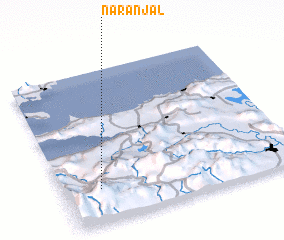 Places with similar names to Naranjal, Venezuela ::
Disclaimer :: Information on this page comes without warranty of any kind |
||
|
Where is Naranjal? Elevation and coordinates ::
Latitude (lat): 10°13'14"N Longitude (lon): 63°50'28"W
Elevation (approx.): 529m (map arrows pan, magnifying glasses zoom) |
||
|
Visiting Naranjal? Hotel/Accommodation ::
Book a hotel in Naranjal Travel Guide ::
Buy a travel guide for Venezuela rental cars ::
car rental offers GPS waypoint ::
download a GPX waypoint (PoI) of Naranjal for your GPS receiver
|
||