|
search place name
|
||
La Lagunita (Carabobo, Venezuela)La Lagunita is a town in the Carabobo region of Venezuela. An overview map of the region around La Lagunita is displayed below.
regional and 3d topo map of La Lagunita, Venezuela ::

La Lagunita airports ::
The nearest airport is VLN - Valencia Arturo Michelena Intl, located 26.2 km east of La Lagunita.
Other airports nearby include PBL - Puerto Cabello General Bartolome Salom Intl (45.4 km north), SFH - San Felipe Sub Teniente Nestor Arias (69.3 km west), BRM - Barquisimeto Intl (131.9 km west), AGV - Acarigua Oswaldo Guevara Mujica (132.1 km south west), Nearby towns ::
La India (1.4km north east) //
Barrera Abajo (2.0km north) //
San Rafael (3.1km south east) //
El Escondido (3.2km south) //
Canaposare (3.8km north) //
Barrenas (3.9km north west) //
Barrera Arriba (4.2km north west) //
La Yaguara (5.1km south east) //
Pueblo Nuevo (5.3km south) //
Santa Isabel (5.6km south east) //
Las Vegas (5.6km north east) //
El Rosario (5.7km north east) //
Cañaveral (6.0km north east) //
Camburito (6.1km north west) //
Aguita de Dios (6.3km north west) //
Palma Bonita (6.6km south west) //
Algarrobal (6.6km south west) //
Alto de Cañafístola (6.6km south east) //
Santa Bárbara (6.7km west) //
Campo de Carabobo (6.8km south) //
El Oasis (6.8km east) //
Las Manzanas (7.3km south) //
La Guásima (7.5km north east) //
El Salto (7.7km west) //
Tierra Adentro (7.9km north west) //
Gualembe (8.3km south) //
La Guásima (8.3km north east) //
Tocuyito (8.3km east) //
La Mona (8.6km north west) //
[all distances 'as the bird flies' and approximate] 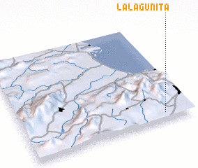 Places with similar names to La Lagunita, Venezuela ::
// Lilkendey (DE)
// La Lagunita (PA)
// Luli Kāndi (BD)
// Liligondé (BF)
// Liligonndé (BF)
// La Lagunita (CO)
// La Lagunita (CO)
// Lolekunda (CD)
// La Laguneta (SV)
// La Laguneta (SV)
Disclaimer :: Information on this page comes without warranty of any kind |
||
|
Where is La Lagunita? Elevation and coordinates ::
Latitude (lat): 10°4'41"N Longitude (lon): 68°9'22"W
Elevation (approx.): 526m (map arrows pan, magnifying glasses zoom) |
||
|
Visiting La Lagunita? Hotel/Accommodation ::
Book a hotel in La Lagunita Travel Guide ::
Buy a travel guide for Venezuela rental cars ::
car rental offers GPS waypoint ::
download a GPX waypoint (PoI) of La Lagunita for your GPS receiver
|
||