|
search place name
|
||
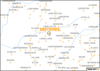
Santa Inés (Cojedes, Venezuela)Santa Inés is a town in the Cojedes region of Venezuela. An overview map of the region around Santa Inés is displayed below.
regional and 3d topo map of Santa Inés, Venezuela ::
Santa Inés airports ::
The nearest airport is SFH - San Felipe Sub Teniente Nestor Arias, located 47.0 km north of Santa Inés.
Other airports nearby include AGV - Acarigua Oswaldo Guevara Mujica (73.2 km south west), BRM - Barquisimeto Intl (80.1 km west), VLN - Valencia Arturo Michelena Intl (85.1 km east), PBL - Puerto Cabello General Bartolome Salom Intl (92.8 km north east), Nearby towns ::
El Cacao (1.8km west) //
El Regalo (2.4km north west) //
Cogollalito (2.5km north) //
Tierra Bonita (2.6km north east) //
Las Gallinas (2.6km south west) //
Tucuragua (4.0km west) //
San Pedro (4.1km north east) //
Llanada Pablo (4.1km south east) //
San Rafael (4.6km north east) //
Campo Alegre (4.7km east) //
El Portón (4.8km south west) //
Santa María (5.1km north) //
San Pablo (5.1km east) //
Paja Brava (5.3km south east) //
La Mata de Buria (5.4km south) //
El Tigre (5.8km west) //
Mata Negra (5.9km north) //
Las Tres Personas (5.9km north west) //
La Veguita (6.7km south west) //
La Florida (6.8km north west) //
San Miguel (7.1km east) //
La Concepción (7.2km west) //
Berreblén (7.3km east) //
Los Plancitos (7.6km north) //
San Rafael (7.5km west) //
Santa María (7.5km west) //
San Francisco (7.6km south) //
La Sierra (7.8km north east) //
El Amarillo (7.8km south west) //
[all distances 'as the bird flies' and approximate] 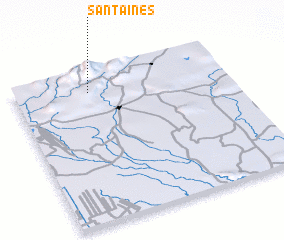 Places with similar names to Santa Inés, Venezuela ::
// Santa Inês (BR)
// Santa Inês (BR)
// Santa Inês (BR)
// Santo Inácio (BR)
// Santo Inácio (BR)
// Santo Inácio (BR)
// Santo Inácio (BR)
// Santo Inácio (BR)
// Santo Inácio (BR)
// Santa Ynez (US)
Disclaimer :: Information on this page comes without warranty of any kind |
||
|
Where is Santa Inés? Elevation and coordinates ::
Latitude (lat): 9°52'0"N Longitude (lon): 68°39'0"W
Elevation (approx.): 735m (map arrows pan, magnifying glasses zoom) |
||
|
Visiting Santa Inés? Hotel/Accommodation ::
Book a hotel in Santa Inés Travel Guide ::
Buy a travel guide for Venezuela rental cars ::
car rental offers GPS waypoint ::
download a GPX waypoint (PoI) of Santa Inés for your GPS receiver
|
||