|
search place name
|
||
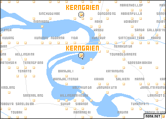
Ker NʼGaien (Gambia, The)Ker NʼGaien is a town in Gambia, The. An overview map of the region around Ker NʼGaien is displayed below.
regional and 3d topo map of Ker NʼGaien, Gambia, The ::
Ker NʼGaien airports ::
The nearest airport is KLC - Kaolack, located 135.2 km north west of Ker NʼGaien.
Other airports nearby include TUD - Tambacounda (137.2 km east), ZIG - Ziguinchor (190.1 km south west), BJL - Banjul Intl (190.7 km west), BXO - Bissau Oswaldo Vieira Intl (208.3 km south west), Nearby towns ::
Sukuta (1.9km south) //
Tuba Koto (1.8km east) //
Yida (4.1km north west) //
Tuba Kuta (4.1km north east) //
Jakaba (4.1km north east) //
Barajali (5.2km south west) //
Medina (5.2km north west) //
Kuntaur (5.2km north east) //
Kuntaur Fula Kunda (5.7km east) //
Barajali Tenda (6.6km south west) //
Wassu (6.6km north east) //
NʼDorrna (6.6km north west) //
Misira (6.6km north west) //
Kai Hai (6.6km south east) //
Pallan Mandinka (6.6km north east) //
Walli Kunda (7.4km south) //
Sinchu Jenun Touray (7.6km north) //
Darusalameh (7.6km north) //
Kai Hai Fula Kunda (7.8km south east) //
Sambel Kunda (8.1km north west) //
Tuba Demba Sama (8.1km north west) //
Fas (8.1km south east) //
Fas Maundeh (8.1km south east) //
Kayainding (8.1km south east) //
Maka (8.2km north east) //
Madina (8.2km north east) //
Pallan Toranka (8.1km north east) //
Kerr Sait Maram (8.1km north east) //
Jarume Kuta (9.2km south east) //
[all distances 'as the bird flies' and approximate]  Places with similar names to Ker NʼGaien, Gambia, The ::
// Carangan (PH)
// Carangan (PH)
// Carangan (PH)
// Caranguian (PH)
// Carañugan (PH)
// Carinogan (PH)
// Cauriñgan (PH)
// Carnigan (US)
// Crîngu Nou (RO)
// Grankina (RU)
Disclaimer :: Information on this page comes without warranty of any kind |
||
|
Where is Ker NʼGaien? Elevation and coordinates ::
Latitude (lat): 13°38'0"N Longitude (lon): 14°55'0"W
Elevation (approx.): 3m (map arrows pan, magnifying glasses zoom) |
||
|
Visiting Ker NʼGaien? Hotel/Accommodation ::
Book a hotel in Ker NʼGaien Travel Guide ::
Buy a travel guide for Gambia, The rental cars ::
car rental offers GPS waypoint ::
download a GPX waypoint (PoI) of Ker NʼGaien for your GPS receiver
|
||