|
search place name
|
||
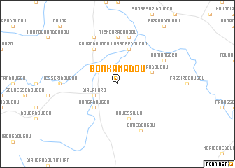
Bonkamadou (Macenta, Guinea)Bonkamadou is a town in the Macenta region of Guinea. An overview map of the region around Bonkamadou is displayed below.
regional and 3d topo map of Bonkamadou, Guinea ::
Bonkamadou airports ::
The nearest airport is MJC - Man, located 164.3 km south east of Bonkamadou.
Other airports nearby include DJO - Daloa (287.3 km south east), Nearby towns ::
Dialakoro (4.1km south west) //
Mangadougou (5.2km south west) //
Koniandougou (5.8km east) //
Mossofédougou (5.9km north) //
Kouéssilla (5.9km south) //
Komandougou (6.7km north west) //
Tiékouradougou (7.4km north) //
Sougbéssédougou (7.6km north) //
Ojo de Agua (7.6km north) //
Biniédougou (8.3km south east) //
Sounandougou (8.3km north west) //
Kaniangoro (8.2km north east) //
[all distances 'as the bird flies' and approximate]  Places with similar names to Bonkamadou, Guinea ::
// Ben Guemoud (MA)
// Ban Kam Maet (TH)
// Ban Kam Maet (TH)
// Ban Na Kaum Tai (TH)
// Ban Ngom Mot (TH)
// Bangamote (CD)
// Ban Kèomat (LA)
// Buôn Ea Kmăt (VN)
// Buôn Ea Kmŭt (VN)
// Bungmati (NP)
Disclaimer :: Information on this page comes without warranty of any kind |
||
|
Where is Bonkamadou? Elevation and coordinates ::
Latitude (lat): 8°29'0"N Longitude (lon): 8°27'0"W
Elevation (approx.): 659m (map arrows pan, magnifying glasses zoom) |
||
|
Visiting Bonkamadou? Hotel/Accommodation ::
Book a hotel in Bonkamadou Travel Guide ::
Buy a travel guide for Guinea rental cars ::
car rental offers GPS waypoint ::
download a GPX waypoint (PoI) of Bonkamadou for your GPS receiver
|
||