|
search place name
|
||
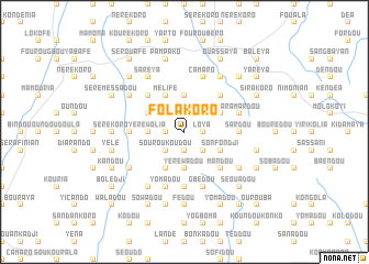
Folakoro (Faranah, Guinea)Folakoro is a town in the Faranah region of Guinea. An overview map of the region around Folakoro is displayed below.
regional and 3d topo map of Folakoro, Guinea ::
Folakoro airports ::
The nearest airport is FAA - Faranah, located 95.9 km north of Folakoro.
Nearby towns ::
Bindou (1.8km east) //
Loya (1.8km east) //
Sandankoro (1.8km east) //
Boafaria (1.8km west) //
Koussoubingou (1.9km south) //
Nougoundou (2.6km north east) //
Kambadou (2.6km south east) //
Souroukoudou (2.6km south west) //
Gbaye (2.6km south west) //
Baléya (3.7km north) //
Yéréwadou (3.7km south) //
Yéréwolia (3.7km west) //
Sonkadou (3.7km west) //
Niandan (4.1km north east) //
Dembaya (4.1km north east) //
Koria (4.1km south east) //
Mélifé (4.1km north west) //
Sonfondji (4.1km south east) //
Boundala (4.1km north west) //
Sirakoro (4.1km south west) //
Saddou (4.1km south west) //
Bambaya Koro (5.2km north east) //
Mandou (5.2km south east) //
Kénéwa (5.2km north west) //
Bindou (5.2km south east) //
Boya (5.6km south) //
Ouendé (5.6km south) //
Laya (5.5km west) //
Koubikoro (5.5km west) //
[all distances 'as the bird flies' and approximate]  Places with similar names to Folakoro, Guinea ::
// Velgur (RU)
// Valkaria (US)
// Felegara (IT)
// Folgaria (IT)
// Voulgáro (GR)
// Falagueira (PT)
// Falagueira (PT)
// Falagueiro (PT)
// Felgar (PT)
// Felgaria (PT)
Disclaimer :: Information on this page comes without warranty of any kind |
||
|
Where is Folakoro? Elevation and coordinates ::
Latitude (lat): 9°13'0"N Longitude (lon): 10°29'0"W
Elevation (approx.): 739m (map arrows pan, magnifying glasses zoom) |
||
|
Visiting Folakoro? Hotel/Accommodation ::
Book a hotel in Folakoro Travel Guide ::
Buy a travel guide for Guinea rental cars ::
car rental offers GPS waypoint ::
download a GPX waypoint (PoI) of Folakoro for your GPS receiver
|
||