|
search place name
|
||
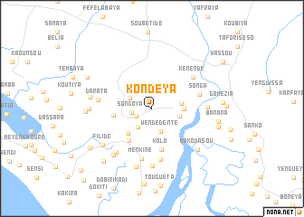
Kondéya (Guinea)Kondéya is a town in Guinea. An overview map of the region around Kondéya is displayed below.
regional and 3d topo map of Kondéya, Guinea ::
Kondéya airports ::
The nearest airport is FIG - Fira Fria, located 44.4 km north east of Kondéya.
Other airports nearby include FNA - Freetown Lungi (162.0 km south), LEK - Labe (216.8 km north east), BXO - Bissau Oswaldo Vieira Intl (298.4 km north west), Nearby towns ::
Béréya (2.2km south west) //
Songoya (2.5km west) //
Fandiékhouré (2.8km south west) //
Kilinkidinguêya (2.9km north west) //
Wendédenté (3.0km south) //
Wawa (3.5km east) //
Baunkoun (3.7km east) //
Sonkolou (4.0km east) //
Kaléta (4.2km south west) //
Baleya (4.7km west) //
Madiné (4.9km south west) //
Kolo (5.2km south) //
Songa (6.0km east) //
Kénendé (6.3km north east) //
Menkiné (6.4km south) //
Sayonya (6.4km south) //
Darata (6.6km west) //
Fafendé (6.8km east) //
Dékouri (6.9km south west) //
Goré (7.0km south) //
Bombondia (7.4km south west) //
Kabéléa (7.5km south) //
Kakounsou (7.5km south east) //
Filidé (7.5km south west) //
Soguéya (7.6km west) //
Débadé (7.7km west) //
Takounkou (8.0km west) //
Banana (8.2km east) //
Maniokhoun (8.3km east) //
[all distances 'as the bird flies' and approximate]  Places with similar names to Kondéya, Guinea ::
// Kendya (RU)
// Konduya (RU)
// Cundiyo (US)
// Kandaye (BF)
// Kondaya (BF)
// Gandaye I (TD)
// Gandaye II (TD)
// Kondya (IN)
// Kannattiya (LK)
// Gandiaye (SN)
Disclaimer :: Information on this page comes without warranty of any kind |
||
|
Where is Kondéya? Elevation and coordinates ::
Latitude (lat): 9°58'54"N Longitude (lon): 13°43'43"W
Elevation (approx.): 32m (map arrows pan, magnifying glasses zoom) |
||
|
Visiting Kondéya? Hotel/Accommodation ::
Book a hotel in Kondéya Travel Guide ::
Buy a travel guide for Guinea rental cars ::
car rental offers GPS waypoint ::
download a GPX waypoint (PoI) of Kondéya for your GPS receiver
|
||